Palmyra night lights from space
Night Light of Palmyra (Pennsylvania) from space (United States) Src. Average luminocity for 10x10km area is 42.9541% and for 50x50km: 25.5057%.
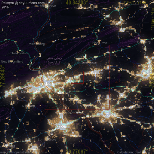
Analysis of Palmyra night lights 2016
Square area 10x10 km:
 4.76%
4.76%90-99
6.8%80-89
8.33%70-79
6.46%60-69
5.1%50-59
5.44%40-49
5.27%30-39
7.48%20-29
14.12%10-19
34.52%0-9
1.7%Square area 50x50 km:
2.94%90-99
3.72%80-89
4.05%70-79
3.43%60-69
3.43%50-59
3.59%40-49
3.53%30-39
4.46%20-29
7.39%10-19
19.91%0-9
43.56%Clear (daylight) street map image can be seen on geolist.org.
Map coordinates:
40° 50' 34.9" North, 77° 17' 47.1" West
40° 18' 32.3" North, 76° 35' 35.9" West
39° 46' 14.4" North, 75° 53' 24.6" West
Some cities around Palmyra sort by population:
• Lebanon
15.8 km =9.8 mi,  77°
77°
• Hershey
5.5 km =3.4 mi,  242°
242°
• Colonial Park
18.4 km =11.4 mi,  267°
267°
• Elizabethtown
17.4 km =10.8 mi,  182°
182°
• Progress
20.4 km =12.7 mi,  262°
262°
• Middletown
16.9 km =10.5 mi,  223°
223°
• Linglestown
16.8 km =10.4 mi,  279°
279°
• Paxtonia
17.1 km =10.6 mi, 273°
5204964 (p: 7,451)
Sources (retrieved 2019-11-25):
» Earth at Night: Flat Maps 2012, 2016