Hershey night lights from space
Night Light of Hershey (Pennsylvania) from space (United States) Src. Average luminocity for 10x10km area is 55.3929% and for 50x50km: 27.3982%.
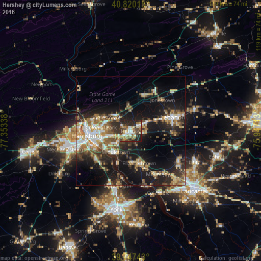
Analysis of Hershey night lights 2016
Square area 10x10 km:
 7.99%
7.99%90-99
9.52%80-89
10.54%70-79
7.82%60-69
7.48%50-59
6.97%40-49
11.05%30-39
9.01%20-29
26.02%10-19
3.57%0-9
0%Square area 50x50 km:
3.42%90-99
3.98%80-89
4.34%70-79
3.64%60-69
3.71%50-59
3.93%40-49
3.92%30-39
4.71%20-29
8.03%10-19
20.14%0-9
40.19%Clear (daylight) street map image can be seen on geolist.org.
Map coordinates:
40° 49' 12.5" North, 77° 21' 12.2" West
40° 17' 9.3" North, 76° 39' 0.9" West
39° 44' 50.7" North, 75° 56' 49.7" West
Some cities around Hershey sort by population:
• Colonial Park
13.6 km =8.5 mi,  276°
276°
• Elizabethtown
15.3 km =9.5 mi,  164°
164°
• Progress
15.4 km =9.6 mi,  269°
269°
• Middletown
11.8 km =7.3 mi,  215°
215°
• Palmyra
5.5 km =3.4 mi,  62°
62°
• Linglestown
12.9 km =8 mi,  294°
294°
• Steelton
17.2 km =10.7 mi,  250°
250°
• Paxtonia
12.7 km =7.9 mi, 285°
5193342 (p: 14,257)
Sources (retrieved 2019-11-25):
» Earth at Night: Flat Maps 2012, 2016