Linglestown night lights from space
Night Light of Linglestown (Pennsylvania) from space (United States) Src. Average luminocity for 10x10km area is 52.1531% and for 50x50km: 25.4933%.
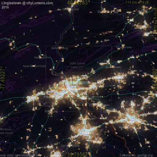
Analysis of Linglestown night lights 2016
Square area 10x10 km:
 6.46%
6.46%90-99
7.48%80-89
7.48%70-79
4.93%60-69
14.29%50-59
14.12%40-49
6.46%30-39
10.37%20-29
10.54%10-19
17.86%0-9
0%Square area 50x50 km:
3.76%90-99
4.13%80-89
3.67%70-79
3.49%60-69
3.8%50-59
3.74%40-49
3.49%30-39
3.99%20-29
6.81%10-19
15.82%0-9
47.31%Clear (daylight) street map image can be seen on geolist.org.
Map coordinates:
40° 52' 4.2" North, 77° 29' 32.2" West
40° 20' 2.3" North, 76° 47' 20.9" West
39° 47' 45.1" North, 76° 5' 9.7" West
Some cities around Linglestown sort by population:
• Harrisburg
10.5 km =6.5 mi,  230°
230°
• Hershey
12.9 km =8 mi,  114°
114°
• Colonial Park
4.1 km =2.5 mi,  205°
205°
• Progress
6.5 km =4 mi, 213°
• New Cumberland
13.9 km =8.6 mi,  215°
215°
• Enola
13.2 km =8.2 mi,  248°
248°
• Steelton
11.8 km =7.3 mi,  201°
201°
• Paxtonia
1.9 km =1.2 mi,  193°
193°
5198180 (p: 6,334)
Sources (retrieved 2019-11-25):
» Earth at Night: Flat Maps 2012, 2016