Oyster Bay night lights from space
Night Light of Oyster Bay (New York) from space (United States) Src. Average luminocity for 10x10km area is 47.4541% and for 50x50km: 61.0638%.
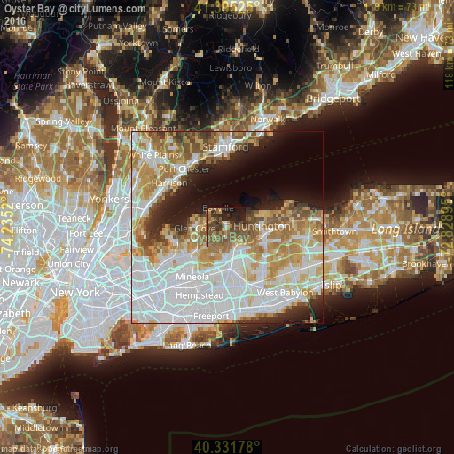
Analysis of Oyster Bay night lights 2016
Square area 10x10 km:
 1.19%
1.19%90-99
1.53%80-89
4.42%70-79
8.16%60-69
9.52%50-59
26.7%40-49
15.65%30-39
8.84%20-29
11.39%10-19
12.59%0-9
0%Square area 50x50 km:
22.17%90-99
14.12%80-89
6.34%70-79
8.07%60-69
8.13%50-59
5.84%40-49
3.63%30-39
2.99%20-29
5.31%10-19
7.6%0-9
15.8%Clear (daylight) street map image can be seen on geolist.org.
Map coordinates:
41° 23' 42.9" North, 74° 14' 6.7" West
40° 51' 56.3" North, 73° 31' 55.5" West
40° 19' 54.4" North, 72° 49' 44.2" West
Some cities around Oyster Bay sort by population:
• Glen Cove
8.6 km =5.3 mi,  267°
267°
• Syosset
5.1 km =3.2 mi,  150°
150°
• Huntington
9 km =5.6 mi,  88°
88°
• Jericho
8.2 km =5.1 mi,  184°
184°
• Woodbury
7 km =4.3 mi,  129°
129°
• Bayville
5.6 km =3.5 mi,  333°
333°
• Cold Spring Harbor
6.4 km =4 mi,  84°
84°
• Sea Cliff
9.7 km =6 mi,  258°
258°
5130327 (p: 6,707)
Sources (retrieved 2019-11-25):
» Earth at Night: Flat Maps 2012, 2016