Bayville night lights from space
Night Light of Bayville (New York) from space (United States) Src. Average luminocity for 10x10km area is 25.5017% and for 50x50km: 60.5182%.
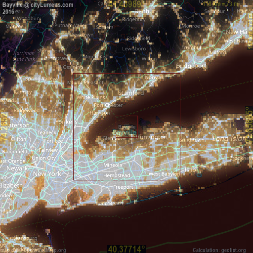
Analysis of Bayville night lights 2016
Square area 10x10 km:
 0.34%
0.34%90-99
0.85%80-89
2.55%70-79
4.59%60-69
4.76%50-59
7.31%40-49
5.95%30-39
7.14%20-29
8.84%10-19
20.58%0-9
37.07%Square area 50x50 km:
19.86%90-99
13.29%80-89
6.65%70-79
8.74%60-69
9.05%50-59
6.89%40-49
4.47%30-39
3.48%20-29
5.45%10-19
8.13%0-9
13.99%Clear (daylight) street map image can be seen on geolist.org.
Map coordinates:
41° 26' 23.6" North, 74° 15' 54.7" West
40° 54' 38.3" North, 73° 33' 43.5" West
40° 22' 37.7" North, 72° 51' 32.2" West
Some cities around Bayville sort by population:
• Glen Cove
8.1 km =5 mi,  228°
228°
• Syosset
10.7 km =6.6 mi,  151°
151°
• Huntington
12.4 km =7.7 mi,  112°
112°
• Woodbury
12.3 km =7.6 mi,  139°
139°
• Oyster Bay
5.6 km =3.5 mi, 153°
• Old Greenwich
12.5 km =7.8 mi,  358°
358°
• Cold Spring Harbor
9.9 km =6.2 mi,  116°
116°
• Sea Cliff
9.8 km =6.1 mi, 225°
5108202 (p: 6,764)
Sources (retrieved 2019-11-25):
» Earth at Night: Flat Maps 2012, 2016