Osceola night lights from space
Night Light of Osceola (Arkansas) from space (United States) Src. Average luminocity for 10x10km area is 20.8462% and for 50x50km: 4.804%.
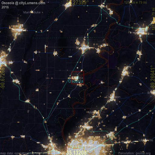
Analysis of Osceola night lights 2016
Square area 10x10 km:
 2.1%
2.1%90-99
3.67%80-89
4.2%70-79
2.1%60-69
1.4%50-59
2.1%40-49
0.87%30-39
4.2%20-29
1.75%10-19
24.13%0-9
53.5%Square area 50x50 km:
0.47%90-99
0.66%80-89
0.59%70-79
0.59%60-69
0.53%50-59
0.59%40-49
0.59%30-39
0.95%20-29
0.55%10-19
4.02%0-9
90.45%Clear (daylight) street map image can be seen on geolist.org.
Map coordinates:
36° 16' 26.4" North, 90° 40' 21.6" West
35° 42' 18.3" North, 89° 58' 10.3" West
35° 7' 55.5" North, 89° 15' 59.1" West
Some cities around Osceola sort by population:
• Blytheville
25.1 km =15.6 mi,  10°
10°
• Arlington
53.3 km =33.1 mi,  148°
148°
• Millington
41 km =25.5 mi,  170°
170°
• Atoka
34.1 km =21.2 mi, 149°
• Covington
33.1 km =20.6 mi,  118°
118°
• Ripley
39.9 km =24.8 mi,  83°
83°
• Trumann
48.7 km =30.3 mi,  265°
265°
• Munford
31.7 km =19.7 mi, 153°
4125027 (p: 7,233)
Sources (retrieved 2019-11-25):
» Earth at Night: Flat Maps 2012, 2016