Millington night lights from space
Night Light of Millington (Tennessee) from space (United States) Src. Average luminocity for 10x10km area is 48.1447% and for 50x50km: 31.0395%.
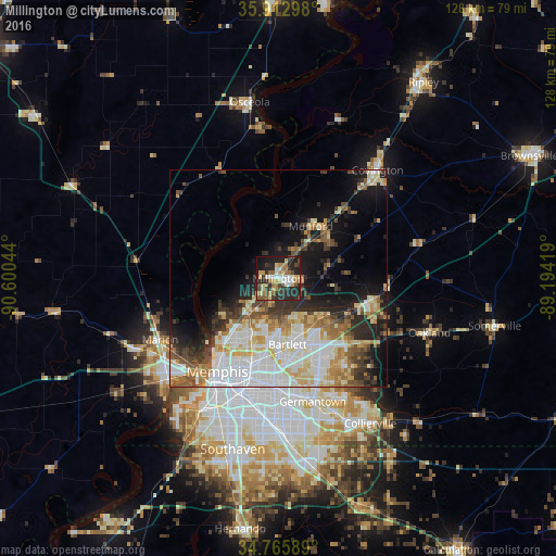
Analysis of Millington night lights 2016
Square area 10x10 km:
 5.49%
5.49%90-99
7.51%80-89
7.51%70-79
6.78%60-69
9.16%50-59
7.33%40-49
6.96%30-39
8.06%20-29
24.91%10-19
14.84%0-9
1.47%Square area 50x50 km:
8.25%90-99
6.13%80-89
4.51%70-79
3.32%60-69
3.54%50-59
3.39%40-49
3.11%30-39
3.97%20-29
5.93%10-19
10.58%0-9
47.27%Clear (daylight) street map image can be seen on geolist.org.
Map coordinates:
35° 54' 46.7" North, 90° 36' 1.6" West
35° 20' 29.3" North, 89° 53' 50.3" West
34° 45' 57.2" North, 89° 11' 39.1" West
Some cities around Millington sort by population:
• Memphis
25.4 km =15.8 mi,  212°
212°
• Bartlett
15.4 km =9.6 mi,  172°
172°
• Germantown
29.4 km =18.3 mi,  164°
164°
• Lakeland
18.8 km =11.7 mi,  130°
130°
• Marion
30.6 km =19 mi,  242°
242°
• Arlington
22 km =13.7 mi,  103°
103°
• Atoka
15.5 km =9.6 mi,  44°
44°
• Munford
14.1 km =8.8 mi,  31°
31°
4641998 (p: 11,027)
Sources (retrieved 2019-11-25):
» Earth at Night: Flat Maps 2012, 2016