Oklahoma City night lights from space
Night Light of Oklahoma City (Oklahoma) from space (United States) Src. Average luminocity for 10x10km area is 98.9634% and for 50x50km: 59.1529%.
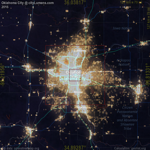
Analysis of Oklahoma City night lights 2016
Square area 10x10 km:
 71.98%
90-99
24.73%80-89
1.83%70-79
1.47%60-69
0%50-59
0%40-49
0%30-39
0%20-29
0%10-19
0%0-9
0%Square area 50x50 km:
14.21%90-99
11.92%80-89
7.94%70-79
7.97%60-69
10.25%50-59
8.67%40-49
7.28%30-39
7.19%20-29
8.81%10-19
9.06%0-9
6.71%Clear (daylight) street map image can be seen on geolist.org.
Map coordinates:
36° 2' 17.4" North, 98° 13' 10.4" West
35° 28' 3.2" North, 97° 30' 59.1" West
34° 53' 34.3" North, 96° 48' 47.9" West
Some cities around Oklahoma City sort by population:
• Edmond
20.9 km =13 mi,  9°
9°
• Moore
14.5 km =9 mi,  169°
169°
• Midwest City
11 km =6.8 mi,  100°
100°
• Del City
7.4 km =4.6 mi,  112°
112°
• Mustang
21 km =13 mi,  243°
243°
• Bethany
11.9 km =7.4 mi,  298°
298°
• Warr Acres
11.1 km =6.9 mi, 303°
• The Village
10.9 km =6.8 mi,  343°
343°
4544349 (p: 631,346)
Sources (retrieved 2019-11-25):
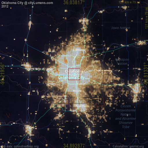
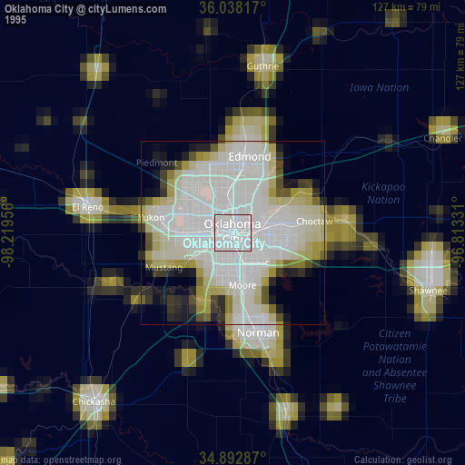
» NASA, Earths city lights 1995
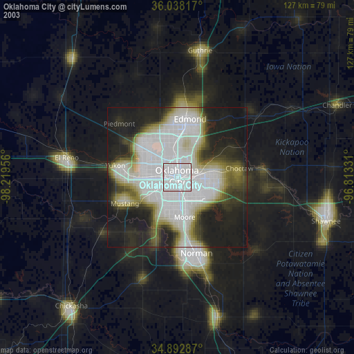
» NASA city lights 2003
» Earth at Night: Flat Maps 2012, 2016