Oceanside night lights from space
Night Light of Oceanside (California) from space (United States) Src. Average luminocity for 10x10km area is 46.4423% and for 50x50km: 21.0241%.
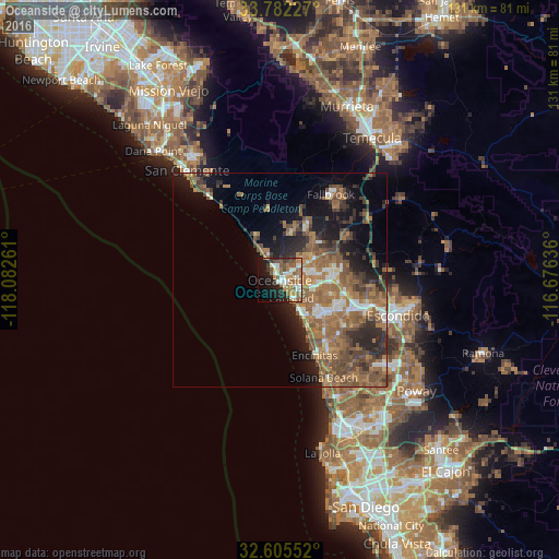
Analysis of Oceanside night lights 2016
Square area 10x10 km:
 7.17%
7.17%90-99
9.79%80-89
4.02%70-79
3.85%60-69
12.76%50-59
9.97%40-49
5.77%30-39
4.72%20-29
8.57%10-19
20.98%0-9
12.41%Square area 50x50 km:
1.93%90-99
2.19%80-89
1.1%70-79
1.55%60-69
7.58%50-59
6.42%40-49
4.66%30-39
3.33%20-29
5.38%10-19
8.63%0-9
57.22%Clear (daylight) street map image can be seen on geolist.org.
Map coordinates:
33° 46' 56.2" North, 118° 4' 57.4" West
33° 11' 45.1" North, 117° 22' 46.1" West
32° 36' 19.9" North, 116° 40' 34.9" West
Some cities around Oceanside sort by population:
• Carlsbad
5 km =3.1 mi,  147°
147°
• Vista
12.7 km =7.9 mi,  87°
87°
• San Marcos
20.7 km =12.9 mi,  106°
106°
• Encinitas
19.5 km =12.1 mi,  155°
155°
• Fallbrook
23.4 km =14.5 mi,  30°
30°
• Solana Beach
24.9 km =15.5 mi, 156°
• Camp Pendleton South
3.6 km =2.2 mi,  0°
0°
• Camp Pendleton North
14.5 km =9 mi,  24°
24°
5378771 (p: 175,691)
Sources (retrieved 2019-11-25):
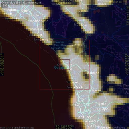
» NASA, Earths city lights 1995
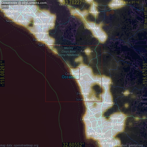
» NASA city lights 2003
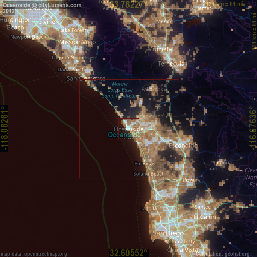
» Earth at Night: Flat Maps 2012, 2016