North Vernon night lights from space
Night Light of North Vernon (Indiana) from space (United States) Src. Average luminocity for 10x10km area is 24.3101% and for 50x50km: 5.3519%.
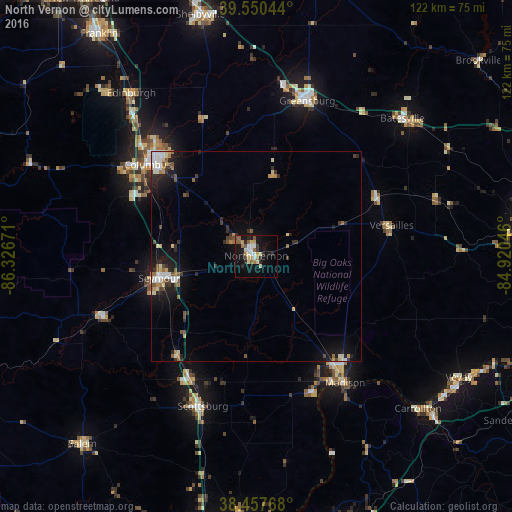
Analysis of North Vernon night lights 2016
Square area 10x10 km:
 2.76%
2.76%90-99
4.71%80-89
3.08%70-79
2.92%60-69
2.44%50-59
5.03%40-49
0.97%30-39
2.27%20-29
5.36%10-19
25.16%0-9
45.29%Square area 50x50 km:
0.71%90-99
0.92%80-89
0.56%70-79
0.51%60-69
0.62%50-59
0.72%40-49
0.53%30-39
0.78%20-29
1.3%10-19
4.53%0-9
88.82%Clear (daylight) street map image can be seen on geolist.org.
Map coordinates:
39° 33' 1.6" North, 86° 19' 36.2" West
39° 0' 22.2" North, 85° 37' 24.9" West
38° 27' 27.6" North, 84° 55' 13.7" West
Some cities around North Vernon sort by population:
• Columbus
33.6 km =20.9 mi,  310°
310°
• Seymour
23.6 km =14.7 mi,  257°
257°
• Shelbyville
58.8 km =36.5 mi,  347°
347°
• Madison
36.7 km =22.8 mi,  144°
144°
• Greensburg
38.7 km =24 mi,  18°
18°
• Scottsburg
37.8 km =23.5 mi,  199°
199°
• Batesville
47.6 km =29.6 mi,  46°
46°
• Salem
60.8 km =37.8 mi,  222°
222°
4262318 (p: 6,619)
Sources (retrieved 2019-11-25):
» Earth at Night: Flat Maps 2012, 2016