North Bend night lights from space
Night Light of North Bend (Washington) from space (United States) Src. Average luminocity for 10x10km area is 11.7472% and for 50x50km: 7.6034%.
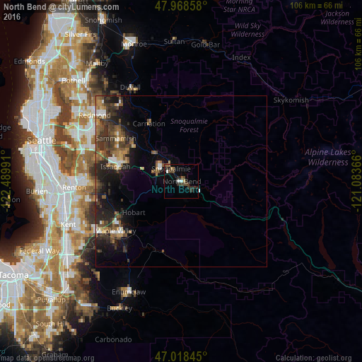
Analysis of North Bend night lights 2016
Square area 10x10 km:
 1.42%
1.42%90-99
0.85%80-89
0.85%70-79
0.28%60-69
0.43%50-59
1.85%40-49
4.12%30-39
4.69%20-29
3.84%10-19
1.99%0-9
79.69%Square area 50x50 km:
0.61%90-99
0.76%80-89
0.59%70-79
0.63%60-69
1.23%50-59
1.64%40-49
1.91%30-39
2.29%20-29
2.92%10-19
4.76%0-9
82.66%Clear (daylight) street map image can be seen on geolist.org.
Map coordinates:
47° 58' 6.9" North, 122° 29' 23.7" West
47° 29' 44.4" North, 121° 47' 12.4" West
47° 1' 6.4" North, 121° 5' 1.2" West
Some cities around North Bend sort by population:
• City of Sammamish
22.4 km =13.9 mi,  302°
302°
• Issaquah
18.9 km =11.7 mi,  281°
281°
• West Lake Sammamish
25.3 km =15.7 mi,  291°
291°
• Maple Valley
22.6 km =14 mi,  239°
239°
• Snoqualmie
4.7 km =2.9 mi,  321°
321°
• East Renton Highlands
24.5 km =15.2 mi,  267°
267°
• Klahanie
18.6 km =11.6 mi, 296°
• Hobart
16.2 km =10.1 mi, 239°
5804915 (p: 6,679)
Sources (retrieved 2019-11-25):
» Earth at Night: Flat Maps 2012, 2016