Niles night lights from space
Night Light of Niles (Michigan) from space (United States) Src. Average luminocity for 10x10km area is 31.727% and for 50x50km: 21.716%.
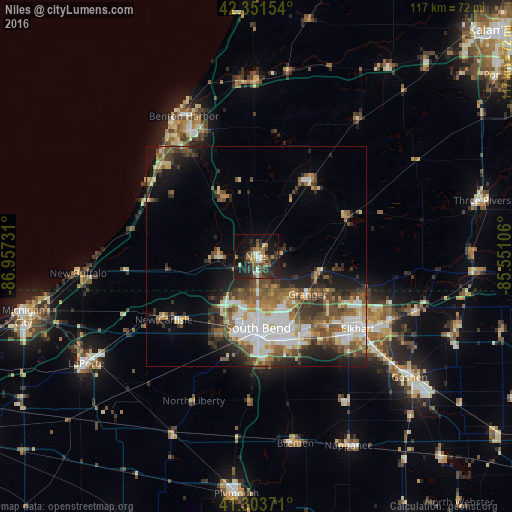
Analysis of Niles night lights 2016
Square area 10x10 km:
 1.75%
1.75%90-99
4.44%80-89
1.59%70-79
3.49%60-69
5.4%50-59
7.62%40-49
6.98%30-39
6.83%20-29
13.49%10-19
29.84%0-9
18.57%Square area 50x50 km:
4.18%90-99
3.44%80-89
2.22%70-79
2.27%60-69
3.25%50-59
4.03%40-49
4.2%30-39
3.4%20-29
5.11%10-19
7.51%0-9
60.38%Clear (daylight) street map image can be seen on geolist.org.
Map coordinates:
42° 21' 5.5" North, 86° 57' 26.3" West
41° 49' 47.2" North, 86° 15' 15" West
41° 18' 13.4" North, 85° 33' 3.8" West
Some cities around Niles sort by population:
• South Bend
16.3 km =10.1 mi,  178°
178°
• Elkhart
28.3 km =17.6 mi,  125°
125°
• Mishawaka
20.3 km =12.6 mi,  156°
156°
• Granger
14.6 km =9.1 mi, 125°
• Fair Plain
33.1 km =20.6 mi,  329°
329°
• Dunlap
34.9 km =21.7 mi, 127°
• Notre Dame
14.5 km =9 mi,  174°
174°
• Dowagiac
21 km =13 mi,  35°
35°
5003514 (p: 11,333)
Sources (retrieved 2019-11-25):
» Earth at Night: Flat Maps 2012, 2016