Granger night lights from space
Night Light of Granger (Indiana) from space (United States) Src. Average luminocity for 10x10km area is 43.1461% and for 50x50km: 25.1645%.
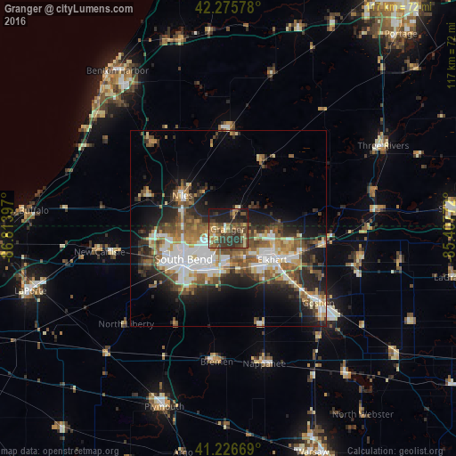
Analysis of Granger night lights 2016
Square area 10x10 km:
 0.49%
0.49%90-99
2.76%80-89
6.17%70-79
5.68%60-69
8.93%50-59
11.2%40-49
13.8%30-39
17.69%20-29
15.42%10-19
17.69%0-9
0.16%Square area 50x50 km:
4.55%90-99
4.03%80-89
2.64%70-79
2.93%60-69
3.67%50-59
4.59%40-49
4.78%30-39
3.76%20-29
6.82%10-19
10.14%0-9
52.1%Clear (daylight) street map image can be seen on geolist.org.
Map coordinates:
42° 16' 32.8" North, 86° 48' 50.3" West
41° 45' 12.2" North, 86° 6' 39" West
41° 13' 36.1" North, 85° 24' 27.8" West
Some cities around Granger sort by population:
• South Bend
13.9 km =8.6 mi,  236°
236°
• Elkhart
13.7 km =8.5 mi,  125°
125°
• Mishawaka
10.9 km =6.8 mi,  201°
201°
• Goshen
29.8 km =18.5 mi, 129°
• Niles
14.6 km =9.1 mi,  305°
305°
• Dunlap
20.3 km =12.6 mi, 129°
• Notre Dame
12.1 km =7.5 mi, 240°
• Dowagiac
25.7 km =16 mi,  0°
0°
4920869 (p: 30,465)
Sources (retrieved 2019-11-25):
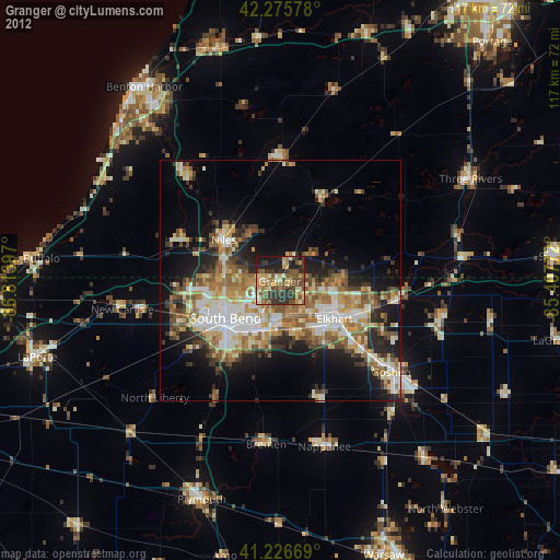
» Earth at Night: Flat Maps 2012, 2016