Niagara Falls night lights from space
Night Light of Niagara Falls (New York) from space (United States) Src. Average luminocity for 10x10km area is 77.4803% and for 50x50km: 32.0556%.
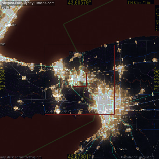
Analysis of Niagara Falls night lights 2016
Square area 10x10 km:
 21.21%
90-99
25%80-89
8.03%70-79
9.24%60-69
11.82%50-59
8.94%40-49
5.15%30-39
8.03%20-29
2.58%10-19
0%0-9
0%Square area 50x50 km:
7.38%90-99
6.86%80-89
3.37%70-79
3.25%60-69
3.74%50-59
4.02%40-49
4.61%30-39
5.03%20-29
7.03%10-19
12.22%0-9
42.49%Clear (daylight) street map image can be seen on geolist.org.
Map coordinates:
43° 36' 20.8" North, 79° 45' 35.4" West
43° 5' 40.2" North, 79° 3' 24.2" West
42° 34' 44.1" North, 78° 21' 12.9" West
Some cities around Niagara Falls sort by population:
• St. Catharines, CA
17.3 km =10.7 mi,  299°
299°
• Welland, CA
20 km =12.4 mi,  231°
231°
• North Tonawanda
16.8 km =10.4 mi,  111°
111°
• Grand Island
10.3 km =6.4 mi,  131°
131°
• Thorold, CA
11.9 km =7.4 mi,  282°
282°
• Fort Erie, CA
23.8 km =14.8 mi,  155°
155°
• Kenmore
20.8 km =12.9 mi, 133°
• Tonawanda
16.5 km =10.3 mi,  119°
119°
5128723 (p: 48,916)
Sources (retrieved 2019-11-25):
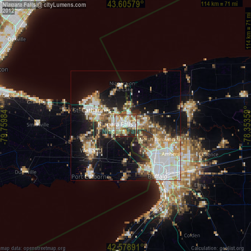
» Earth at Night: Flat Maps 2012, 2016