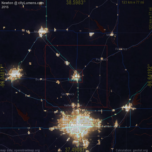
Newton night lights from space
Night Light of Newton (Kansas) from space (United States) Src. Average luminocity for 10x10km area is 30.1834% and for 50x50km: 3.1078%.
Analysis of Newton night lights 2016
Square area 10x10 km:
 2.92%
2.92%90-99
2.92%80-89
2.27%70-79
3.41%60-69
8.6%50-59
8.44%40-49
3.9%30-39
5.68%20-29
2.44%10-19
28.57%0-9
30.84%Square area 50x50 km:
0.19%90-99
0.28%80-89
0.25%70-79
0.4%60-69
0.69%50-59
0.71%40-49
0.44%30-39
0.59%20-29
0.42%10-19
1.97%0-9
94.06%Clear (daylight) street map image can be seen on geolist.org.
Map coordinates:
38° 35' 53.9" North, 98° 2' 53.4" West
38° 2' 48" North, 97° 20' 42.1" West
37° 29' 27.1" North, 96° 38' 30.9" West
Some cities around Newton sort by population:
• Wichita
39.4 km =24.5 mi,  179°
179°
• Hutchinson
51.2 km =31.8 mi,  271°
271°
• McPherson
45.6 km =28.3 mi,  322°
322°
• El Dorado
49.4 km =30.7 mi,  121°
121°
• Andover
41.3 km =25.7 mi,  153°
153°
• Augusta
51.5 km =32 mi,  141°
141°
• Park City
27.5 km =17.1 mi, 175°
• Valley Center
23.7 km =14.7 mi,  186°
186°
4276248 (p: 19,216)
Sources (retrieved 2019-11-25):
» Earth at Night: Flat Maps 2012, 2016