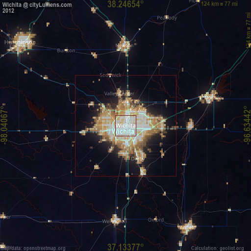
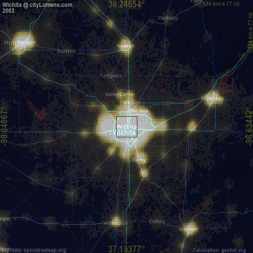
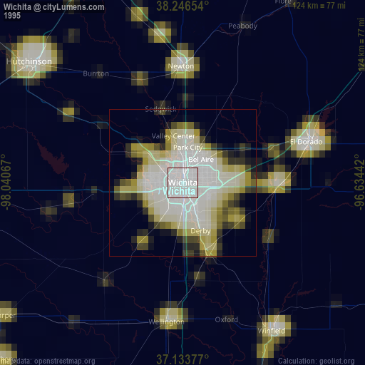
Wichita night lights from space
Night Light of Wichita (Kansas) from space (United States) Src. Average luminocity for 10x10km area is 96.2857% and for 50x50km: 27.023%.
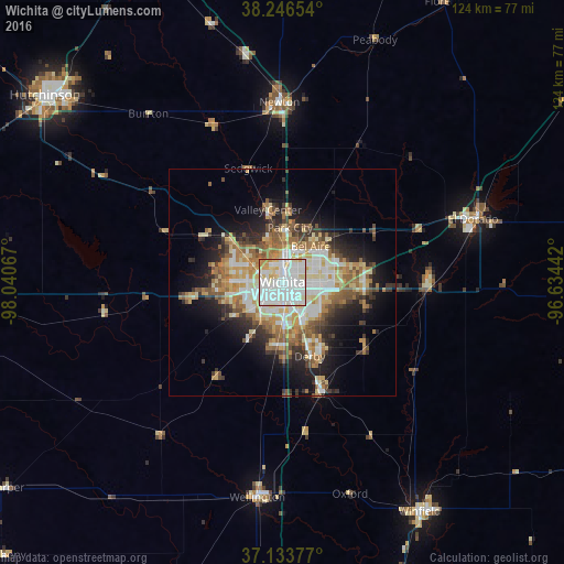
Analysis of Wichita night lights 2016
Square area 10x10 km:
 49.83%
90-99
35.88%80-89
8.16%70-79
4.93%60-69
1.19%50-59
0%40-49
0%30-39
0%20-29
0%10-19
0%0-9
0%Square area 50x50 km:
5.24%90-99
5.25%80-89
4.07%70-79
3.59%60-69
4.36%50-59
3.95%40-49
2.45%30-39
3.61%20-29
4.7%10-19
9.35%0-9
53.44%Clear (daylight) street map image can be seen on geolist.org.
Map coordinates:
38° 14' 47.5" North, 98° 2' 26.4" West
37° 41' 32.1" North, 97° 20' 15.1" West
37° 8' 1.6" North, 96° 38' 3.9" West
Some cities around Wichita sort by population:
• Derby
17.4 km =10.8 mi,  159°
159°
• Newton
39.4 km =24.5 mi,  359°
359°
• Andover
17.9 km =11.1 mi,  82°
82°
• Haysville
14.3 km =8.9 mi,  185°
185°
• Augusta
31.8 km =19.8 mi,  91°
91°
• Park City
12.1 km =7.5 mi,  8°
8°
• Valley Center
16.2 km =10.1 mi,  348°
348°
• Mulvane
25.6 km =15.9 mi, 161°
4281730 (p: 389,965)
Sources (retrieved 2019-11-25):
» NASA, Earths city lights 1995
» NASA city lights 2003
» Earth at Night: Flat Maps 2012, 2016