Live Oak night lights from space
Night Light of Live Oak (Texas) from space (United States) Src. Average luminocity for 10x10km area is 85.2083% and for 50x50km: 46.0671%.
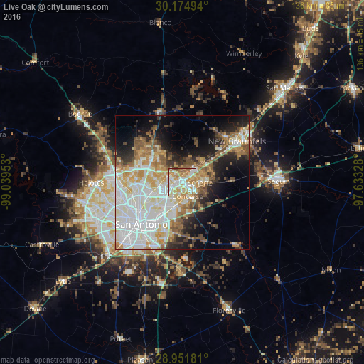
Analysis of Live Oak night lights 2016
Square area 10x10 km:
 21.21%
90-99
25.19%80-89
19.89%70-79
17.8%60-69
10.8%50-59
4.36%40-49
0.19%30-39
0.57%20-29
0%10-19
0%0-9
0%Square area 50x50 km:
13.11%90-99
11.48%80-89
5.5%70-79
6.03%60-69
4.85%50-59
5.32%40-49
4.05%30-39
3.61%20-29
5.65%10-19
10.07%0-9
30.32%Clear (daylight) street map image can be seen on geolist.org.
Map coordinates:
30° 10' 29.8" North, 99° 2' 22.3" West
29° 33' 54.8" North, 98° 20' 11" West
28° 57' 6.5" North, 97° 37' 59.8" West
Some cities around Live Oak sort by population:
• Schertz
6.6 km =4.1 mi,  102°
102°
• Cibolo
10.6 km =6.6 mi,  92°
92°
• Converse
5.6 km =3.5 mi,  159°
159°
• Universal City
4.8 km =3 mi,  113°
113°
• Selma
3.6 km =2.2 mi,  54°
54°
• Kirby
12.3 km =7.6 mi,  202°
202°
• Windcrest
7 km =4.3 mi,  217°
217°
• Terrell Hills
14.9 km =9.3 mi,  227°
227°
4707055 (p: 15,346)
Sources (retrieved 2019-11-25):
» Earth at Night: Flat Maps 2012, 2016