Myrtle Beach night lights from space
Night Light of Myrtle Beach (South Carolina) from space (United States) Src. Average luminocity for 10x10km area is 66.0934% and for 50x50km: 27.7297%.

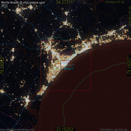
Analysis of Myrtle Beach night lights 2016
Square area 10x10 km:
 25.82%
90-99
20.15%80-89
4.03%70-79
4.58%60-69
2.56%50-59
5.13%40-49
6.41%30-39
4.58%20-29
13%10-19
9.89%0-9
3.85%Square area 50x50 km:
3.86%90-99
4.24%80-89
5.11%70-79
4.77%60-69
5.15%50-59
2.06%40-49
3.11%30-39
4.39%20-29
8.85%10-19
12.6%0-9
45.86%Clear (daylight) street map image can be seen on geolist.org.
Map coordinates:
34° 16' 19.6" North, 79° 35' 23.4" West
33° 41' 20.6" North, 78° 53' 12.1" West
33° 6' 7.3" North, 78° 11' 0.9" West
Some cities around Myrtle Beach sort by population:
• Conway
22.1 km =13.7 mi,  317°
317°
• Socastee
10.4 km =6.5 mi,  266°
266°
• North Myrtle Beach
23.8 km =14.8 mi,  53°
53°
• Red Hill
48.7 km =30.3 mi, 315°
• Garden City
15.5 km =9.6 mi,  226°
226°
• Georgetown
51.3 km =31.9 mi, 227°
• Little River
32.5 km =20.2 mi, 50°
• Murrells Inlet
21 km =13 mi,  223°
223°
4588718 (p: 31,035)
Sources (retrieved 2019-11-25):
» Earth at Night: Flat Maps 2012, 2016