Little River night lights from space
Night Light of Little River (South Carolina) from space (United States) Src. Average luminocity for 10x10km area is 57.1801% and for 50x50km: 16.2927%.
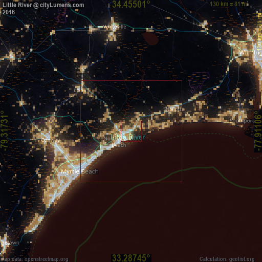
Analysis of Little River night lights 2016
Square area 10x10 km:
 9.44%
9.44%90-99
9.62%80-89
8.39%70-79
13.29%60-69
13.99%50-59
3.67%40-49
5.42%30-39
7.69%20-29
15.91%10-19
10.49%0-9
2.1%Square area 50x50 km:
1.62%90-99
1.57%80-89
2.56%70-79
2.4%60-69
3.19%50-59
1.52%40-49
2.49%30-39
2.85%20-29
6.88%10-19
12.09%0-9
62.83%Clear (daylight) street map image can be seen on geolist.org.
Map coordinates:
34° 27' 18" North, 79° 19' 2.3" West
33° 52' 23.6" North, 78° 36' 51" West
33° 17' 14.8" North, 77° 54' 39.8" West
Some cities around Little River sort by population:
• Myrtle Beach
32.5 km =20.2 mi,  230°
230°
• Conway
40.3 km =25 mi,  264°
264°
• Socastee
41.3 km =25.7 mi,  239°
239°
• North Myrtle Beach
8.8 km =5.5 mi,  223°
223°
• Garden City
48 km =29.8 mi, 229°
• Oak Island
42.1 km =26.2 mi,  83°
83°
• Long Beach
46 km =28.6 mi, 84°
• Whiteville
52.4 km =32.6 mi,  351°
351°
4585421 (p: 8,960)
Sources (retrieved 2019-11-25):
» Earth at Night: Flat Maps 2012, 2016