Morristown night lights from space
Night Light of Morristown (Tennessee) from space (United States) Src. Average luminocity for 10x10km area is 62.3829% and for 50x50km: 10.9671%.
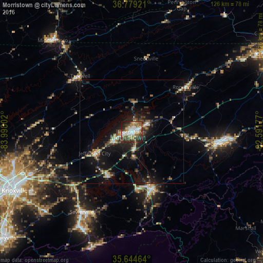
Analysis of Morristown night lights 2016
Square area 10x10 km:
 13.11%
90-99
12.76%80-89
8.57%70-79
9.27%60-69
7.17%50-59
8.57%40-49
13.29%30-39
9.27%20-29
14.16%10-19
3.85%0-9
0%Square area 50x50 km:
0.99%90-99
1.07%80-89
1.26%70-79
1.25%60-69
1.11%50-59
1.56%40-49
1.95%30-39
3.15%20-29
3.23%10-19
10.17%0-9
74.26%Clear (daylight) street map image can be seen on geolist.org.
Map coordinates:
36° 46' 45.2" North, 83° 59' 52.9" West
36° 12' 50.3" North, 83° 17' 41.6" West
35° 38' 40.7" North, 82° 35' 30.4" West
Some cities around Morristown sort by population:
• Sevierville
45.3 km =28.1 mi,  211°
211°
• Greeneville
42 km =26.1 mi,  97°
97°
• Seymour
52.8 km =32.8 mi,  227°
227°
• Middlesboro
57.9 km =36 mi,  319°
319°
• Jefferson City
20.5 km =12.7 mi,  240°
240°
• Newport
29.1 km =18.1 mi,  160°
160°
• Church Hill
62.3 km =38.7 mi,  56°
56°
• Pigeon Forge
52.8 km =32.8 mi, 206°
4642938 (p: 29,478)
Sources (retrieved 2019-11-25):
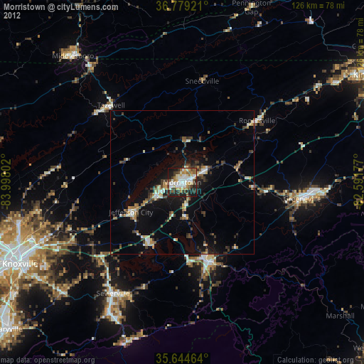
» Earth at Night: Flat Maps 2012, 2016