Moraine night lights from space
Night Light of Moraine (Ohio) from space (United States) Src. Average luminocity for 10x10km area is 87.5779% and for 50x50km: 41.8229%.
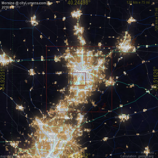
Analysis of Moraine night lights 2016
Square area 10x10 km:
 32.47%
90-99
23.86%80-89
16.07%70-79
14.61%60-69
8.12%50-59
3.25%40-49
1.62%30-39
0%20-29
0%10-19
0%0-9
0%Square area 50x50 km:
7.39%90-99
8.17%80-89
5.81%70-79
6.49%60-69
7.33%50-59
6.2%40-49
5.92%30-39
5.87%20-29
7.4%10-19
10.99%0-9
28.43%Clear (daylight) street map image can be seen on geolist.org.
Map coordinates:
40° 14' 41.9" North, 84° 55' 21" West
39° 42' 22.2" North, 84° 13' 9.8" West
39° 9' 47.2" North, 83° 30' 58.5" West
Some cities around Moraine sort by population:
• Dayton
6.3 km =3.9 mi,  22°
22°
• Kettering
4.7 km =2.9 mi,  113°
113°
• Riverside
11.5 km =7.1 mi,  44°
44°
• Centerville
10.1 km =6.3 mi,  149°
149°
• Miamisburg
9.1 km =5.7 mi,  219°
219°
• West Carrollton City
4.7 km =2.9 mi, 216°
• Oakwood
4.4 km =2.7 mi,  61°
61°
• Northridge
11.4 km =7.1 mi,  9°
9°
4518661 (p: 6,373)
Sources (retrieved 2019-11-25):
» Earth at Night: Flat Maps 2012, 2016