Miamisburg night lights from space
Night Light of Miamisburg (Ohio) from space (United States) Src. Average luminocity for 10x10km area is 55.0373% and for 50x50km: 40.8222%.
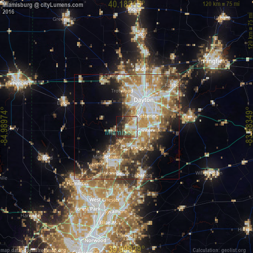
Analysis of Miamisburg night lights 2016
Square area 10x10 km:
 8.93%
8.93%90-99
11.85%80-89
6.98%70-79
8.12%60-69
8.6%50-59
5.19%40-49
12.34%30-39
10.06%20-29
14.94%10-19
11.36%0-9
1.62%Square area 50x50 km:
7.37%90-99
8.25%80-89
5.45%70-79
6.47%60-69
7.13%50-59
6.59%40-49
5.97%30-39
5.76%20-29
6.38%10-19
7.31%0-9
33.32%Clear (daylight) street map image can be seen on geolist.org.
Map coordinates:
40° 10' 55.7" North, 84° 59' 23.1" West
39° 38' 34.2" North, 84° 17' 11.8" West
39° 5' 57.4" North, 83° 35' 0.6" West
Some cities around Miamisburg sort by population:
• Kettering
11.3 km =7 mi,  62°
62°
• Centerville
11 km =6.8 mi,  98°
98°
• Springboro
11.1 km =6.9 mi,  155°
155°
• West Carrollton City
4.4 km =2.7 mi,  42°
42°
• Franklin
9.4 km =5.8 mi,  189°
189°
• Moraine
9.1 km =5.7 mi, 39°
• Germantown
7.3 km =4.5 mi,  255°
255°
• Carlisle
7.4 km =4.6 mi,  203°
203°
4518188 (p: 20,034)
Sources (retrieved 2019-11-25):
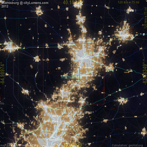
» Earth at Night: Flat Maps 2012, 2016