Dayton night lights from space
Night Light of Dayton (Ohio) from space (United States) Src. Average luminocity for 10x10km area is 97.3844% and for 50x50km: 40.6983%.
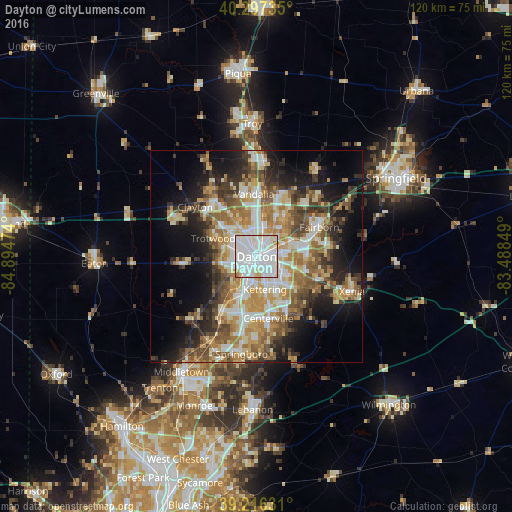
Analysis of Dayton night lights 2016
Square area 10x10 km:
 58.67%
90-99
31.63%80-89
6.46%70-79
2.21%60-69
1.02%50-59
0%40-49
0%30-39
0%20-29
0%10-19
0%0-9
0%Square area 50x50 km:
7.22%90-99
7.84%80-89
5.75%70-79
6.17%60-69
6.98%50-59
5.95%40-49
5.5%30-39
5.49%20-29
7.22%10-19
12.5%0-9
29.37%Clear (daylight) street map image can be seen on geolist.org.
Map coordinates:
40° 17' 50.5" North, 84° 53' 41.1" West
39° 45' 32.2" North, 84° 11' 29.8" West
39° 12' 58.7" North, 83° 29' 18.6" West
Some cities around Dayton sort by population:
• Kettering
8 km =5 mi,  165°
165°
• Huber Heights
11 km =6.8 mi,  31°
31°
• Riverside
6.2 km =3.9 mi,  68°
68°
• West Carrollton City
10.9 km =6.8 mi,  208°
208°
• Shiloh
7.4 km =4.6 mi,  334°
334°
• Oakwood
4 km =2.5 mi,  158°
158°
• Northridge
5.4 km =3.4 mi,  355°
355°
• Moraine
6.3 km =3.9 mi,  202°
202°
4509884 (p: 140,599)
Sources (retrieved 2019-11-25):
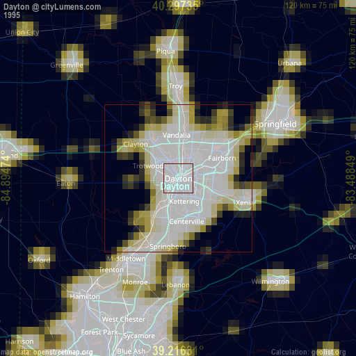
» NASA, Earths city lights 1995
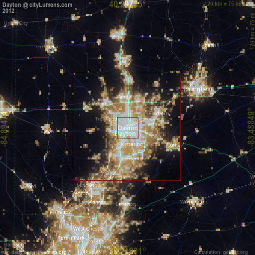
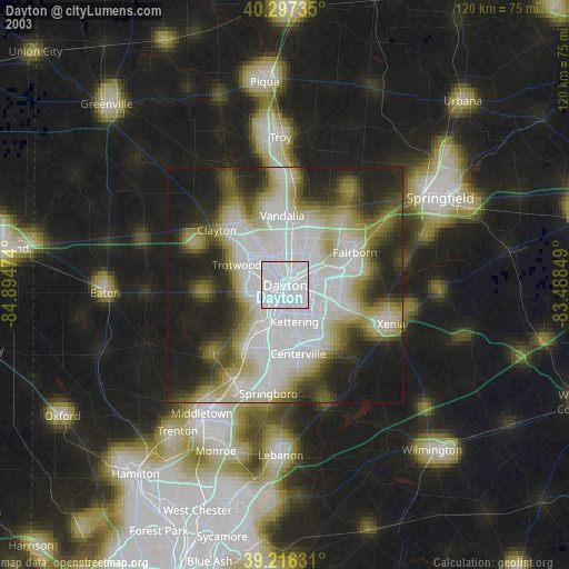
» NASA city lights 2003
» Earth at Night: Flat Maps 2012, 2016