Monson night lights from space
Night Light of Monson (Massachusetts) from space (United States) Src. Average luminocity for 10x10km area is 5.1924% and for 50x50km: 17.8642%.
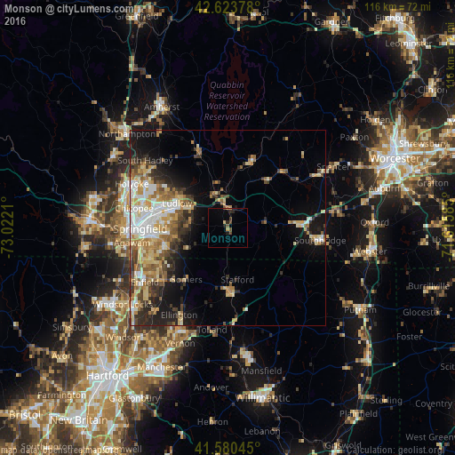
Analysis of Monson night lights 2016
Square area 10x10 km:
 0%
0%90-99
0%80-89
0.61%70-79
0.45%60-69
0.76%50-59
0.91%40-49
2.12%30-39
0.3%20-29
2.12%10-19
1.21%0-9
91.52%Square area 50x50 km:
2.57%90-99
3.01%80-89
3.24%70-79
2.4%60-69
2.7%50-59
2.35%40-49
2.16%30-39
2.76%20-29
3.72%10-19
6.94%0-9
68.14%Clear (daylight) street map image can be seen on geolist.org.
Map coordinates:
42° 37' 25.6" North, 73° 1' 19.6" West
42° 6' 15.3" North, 72° 19' 8.3" West
41° 34' 49.6" North, 71° 36' 57.1" West
Some cities around Monson sort by population:
• Springfield
22.3 km =13.9 mi,  269°
269°
• Ludlow
14.4 km =8.9 mi,  295°
295°
• Palmer
6.1 km =3.8 mi,  352°
352°
• East Longmeadow
16.6 km =10.3 mi,  254°
254°
• Stafford
13.5 km =8.4 mi,  169°
169°
• Ware
18.5 km =11.5 mi,  20°
20°
• Sherwood Manor
22.6 km =14 mi,  243°
243°
• Hampden
9 km =5.6 mi, 240°
4944350 (p: 8,505)
Sources (retrieved 2019-11-25):
» Earth at Night: Flat Maps 2012, 2016