Monsey night lights from space
Night Light of Monsey (New York) from space (United States) Src. Average luminocity for 10x10km area is 72.2078% and for 50x50km: 49.2575%.
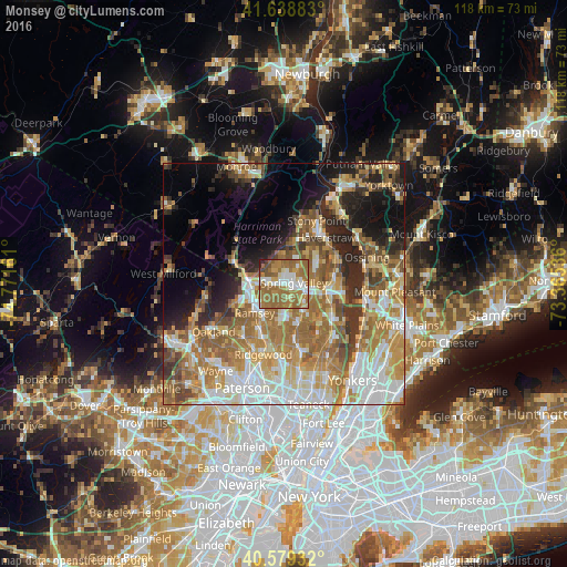
Analysis of Monsey night lights 2016
Square area 10x10 km:
 12.18%
90-99
12.5%80-89
6.01%70-79
9.9%60-69
40.75%50-59
14.12%40-49
2.6%30-39
0.65%20-29
1.3%10-19
0%0-9
0%Square area 50x50 km:
9.24%90-99
9.09%80-89
6.12%70-79
9.08%60-69
12.18%50-59
7.53%40-49
5.05%30-39
4.32%20-29
6.98%10-19
8.88%0-9
21.53%Clear (daylight) street map image can be seen on geolist.org.
Map coordinates:
41° 38' 19.8" North, 74° 46' 17.8" West
41° 6' 40.4" North, 74° 4' 6.5" West
40° 34' 45.6" North, 73° 21' 55.3" West
Some cities around Monsey sort by population:
• Spring Valley
2.1 km =1.3 mi,  84°
84°
• Airmont
4.2 km =2.6 mi,  254°
254°
• Chestnut Ridge
3.2 km =2 mi,  160°
160°
• New Square
4.5 km =2.8 mi,  46°
46°
• Hillcrest
3 km =1.9 mi, 51°
• Viola
3 km =1.9 mi,  337°
337°
• New Hempstead
5.2 km =3.2 mi,  34°
34°
• Kaser
1.1 km =0.7 mi,  5°
5°
5127315 (p: 18,412)
Sources (retrieved 2019-11-25):
» Earth at Night: Flat Maps 2012, 2016