Milledgeville night lights from space
Night Light of Milledgeville (Georgia) from space (United States) Src. Average luminocity for 10x10km area is 49.3846% and for 50x50km: 5.935%.
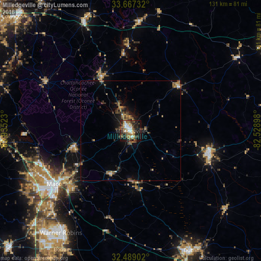
Analysis of Milledgeville night lights 2016
Square area 10x10 km:
 7.51%
7.51%90-99
9.52%80-89
4.76%70-79
6.04%60-69
9.34%50-59
10.99%40-49
6.23%30-39
6.59%20-29
17.4%10-19
20.33%0-9
1.28%Square area 50x50 km:
0.42%90-99
0.49%80-89
0.62%70-79
0.77%60-69
1.05%50-59
1.02%40-49
1.05%30-39
1.56%20-29
1.52%10-19
3.6%0-9
87.89%Clear (daylight) street map image can be seen on geolist.org.
Map coordinates:
33° 40' 2.4" North, 83° 56' 6.8" West
33° 4' 48.5" North, 83° 13' 55.6" West
32° 29' 20.5" North, 82° 31' 44.3" West
Some cities around Milledgeville sort by population:
• Macon
45.9 km =28.5 mi,  234°
234°
• Warner Robins
63.4 km =39.4 mi,  215°
215°
• Dublin
67.4 km =41.9 mi,  152°
152°
• Centerville
65.8 km =40.9 mi, 220°
• Thomson
80.4 km =50 mi,  57°
57°
• Eatonton
31 km =19.3 mi,  332°
332°
• Sandersville
40.8 km =25.4 mi,  105°
105°
• Byron
68.4 km =42.5 mi, 226°
4209448 (p: 18,931)
Sources (retrieved 2019-11-25):
» Earth at Night: Flat Maps 2012, 2016