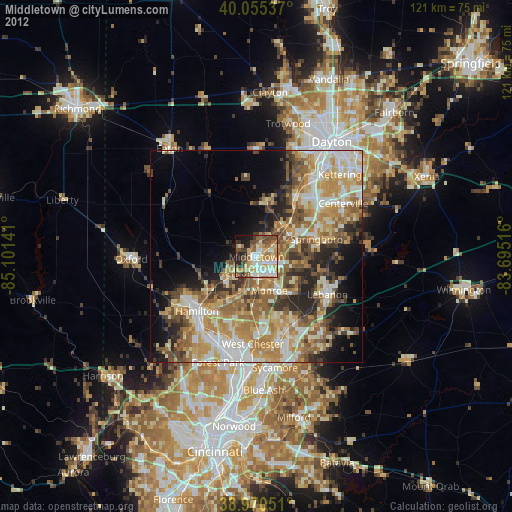
Middletown night lights from space
Night Light of Middletown (Ohio) from space (United States) Src. Average luminocity for 10x10km area is 62.5536% and for 50x50km: 41.4139%.

Analysis of Middletown night lights 2016
Square area 10x10 km:
 11.36%
90-99
14.61%80-89
8.93%70-79
11.36%60-69
10.71%50-59
7.31%40-49
8.93%30-39
7.95%20-29
10.39%10-19
6.82%0-9
1.62%Square area 50x50 km:
6.56%90-99
8.45%80-89
5.66%70-79
8.03%60-69
6.94%50-59
6.46%40-49
5.5%30-39
6.2%20-29
6.79%10-19
7.41%0-9
32.01%Clear (daylight) street map image can be seen on geolist.org.
Map coordinates:
40° 3' 19.3" North, 85° 6' 5.1" West
39° 30' 54.2" North, 84° 23' 53.8" West
38° 58' 13.8" North, 83° 41' 42.6" West
Some cities around Middletown sort by population:
• Mason
18.8 km =11.7 mi,  156°
156°
• Miamisburg
17.1 km =10.6 mi,  33°
33°
• Springboro
14.7 km =9.1 mi,  73°
73°
• Monroe
8.9 km =5.5 mi, 159°
• Trenton
6.4 km =4 mi,  233°
233°
• Franklin
9.4 km =5.8 mi,  58°
58°
• Germantown
12.6 km =7.8 mi,  11°
11°
• Carlisle
10 km =6.2 mi,  41°
41°
4518264 (p: 48,760)
Sources (retrieved 2019-11-25):
» Earth at Night: Flat Maps 2012, 2016