Middle Valley night lights from space
Night Light of Middle Valley (Tennessee) from space (United States) Src. Average luminocity for 10x10km area is 51.2045% and for 50x50km: 26.5868%.
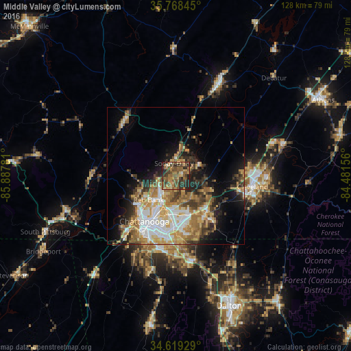
Analysis of Middle Valley night lights 2016
Square area 10x10 km:
 0.7%
0.7%90-99
2.27%80-89
6.64%70-79
10.84%60-69
12.24%50-59
21.15%40-49
12.94%30-39
15.91%20-29
14.86%10-19
2.45%0-9
0%Square area 50x50 km:
4.74%90-99
4.07%80-89
3.96%70-79
4.51%60-69
4.64%50-59
3.94%40-49
3.09%30-39
4.53%20-29
4.68%10-19
8.4%0-9
53.45%Clear (daylight) street map image can be seen on geolist.org.
Map coordinates:
35° 46' 6.4" North, 85° 53' 16.1" West
35° 11' 45.2" North, 85° 11' 4.8" West
34° 37' 9.4" North, 84° 28' 53.6" West
Some cities around Middle Valley sort by population:
• Chattanooga
20.2 km =12.6 mi,  214°
214°
• East Chattanooga
15.7 km =9.8 mi,  201°
201°
• East Ridge
21.1 km =13.1 mi, 196°
• Soddy-Daisy
4.5 km =2.8 mi,  352°
352°
• Red Bank
13.6 km =8.5 mi,  226°
226°
• Collegedale
20 km =12.4 mi,  142°
142°
• Signal Mountain
16.6 km =10.3 mi,  240°
240°
• Harrison
10.1 km =6.3 mi,  155°
155°
4641495 (p: 12,684)
Sources (retrieved 2019-11-25):
» Earth at Night: Flat Maps 2012, 2016