Soddy-Daisy night lights from space
Night Light of Soddy-Daisy (Tennessee) from space (United States) Src. Average luminocity for 10x10km area is 41.0909% and for 50x50km: 22.2897%.
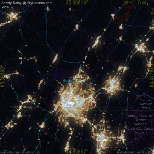
Analysis of Soddy-Daisy night lights 2016
Square area 10x10 km:
 0.7%
0.7%90-99
2.1%80-89
5.59%70-79
8.57%60-69
7.69%50-59
14.16%40-49
9.79%30-39
11.19%20-29
11.71%10-19
20.1%0-9
8.39%Square area 50x50 km:
3.95%90-99
3.27%80-89
3.14%70-79
3.49%60-69
3.88%50-59
3.28%40-49
2.87%30-39
4.09%20-29
4.36%10-19
7.55%0-9
60.13%Clear (daylight) street map image can be seen on geolist.org.
Map coordinates:
35° 48' 29.4" North, 85° 53' 38.1" West
35° 14' 9.2" North, 85° 11' 26.8" West
34° 39' 34.5" North, 84° 29' 15.6" West
Some cities around Soddy-Daisy sort by population:
• Chattanooga
23.8 km =14.8 mi,  207°
207°
• East Chattanooga
19.7 km =12.2 mi,  195°
195°
• Middle Valley
4.5 km =2.8 mi,  172°
172°
• Red Bank
16.6 km =10.3 mi, 214°
• Collegedale
24 km =14.9 mi,  147°
147°
• Signal Mountain
18.8 km =11.7 mi,  227°
227°
• Harrison
14.4 km =8.9 mi,  160°
160°
• Dunlap
23.6 km =14.7 mi,  309°
309°
4658766 (p: 13,171)
Sources (retrieved 2019-11-25):
» Earth at Night: Flat Maps 2012, 2016