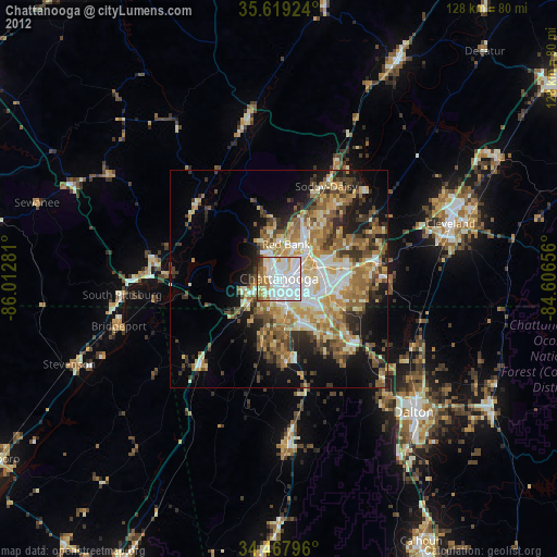
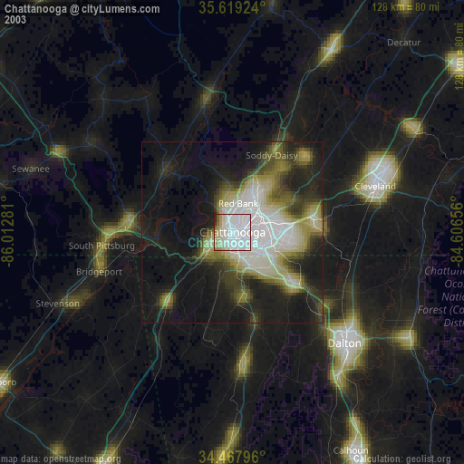
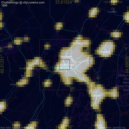
Chattanooga night lights from space
Night Light of Chattanooga (Tennessee) from space (United States) Src. Average luminocity for 10x10km area is 86.6136% and for 50x50km: 31.5735%.
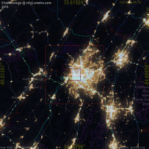
Analysis of Chattanooga night lights 2016
Square area 10x10 km:
 42.31%
90-99
22.38%80-89
7.17%70-79
8.39%60-69
6.47%50-59
5.77%40-49
3.15%30-39
2.8%20-29
1.57%10-19
0%0-9
0%Square area 50x50 km:
5.01%90-99
4.42%80-89
4.92%70-79
5.3%60-69
5.88%50-59
4.76%40-49
4.41%30-39
6.15%20-29
6.04%10-19
10.03%0-9
43.08%Clear (daylight) street map image can be seen on geolist.org.
Map coordinates:
35° 37' 9.3" North, 86° 0' 46.1" West
35° 2' 44.3" North, 85° 18' 34.8" West
34° 28' 4.7" North, 84° 36' 23.6" West
Some cities around Chattanooga sort by population:
• East Chattanooga
5.9 km =3.7 mi,  68°
68°
• East Ridge
6.3 km =3.9 mi,  123°
123°
• East Brainerd
15.5 km =9.6 mi,  110°
110°
• Red Bank
7.5 km =4.7 mi,  10°
10°
• Fort Oglethorpe
11.8 km =7.3 mi,  155°
155°
• Signal Mountain
9.1 km =5.7 mi,  340°
340°
• Harrison
17.4 km =10.8 mi,  64°
64°
• Fairview
11.4 km =7.1 mi,  168°
168°
4612862 (p: 176,588)
Sources (retrieved 2019-11-25):
» NASA, Earths city lights 1995
» NASA city lights 2003
» Earth at Night: Flat Maps 2012, 2016