Meriden night lights from space
Night Light of Meriden (Connecticut) from space (United States) Src. Average luminocity for 10x10km area is 63.4762% and for 50x50km: 40.8477%.
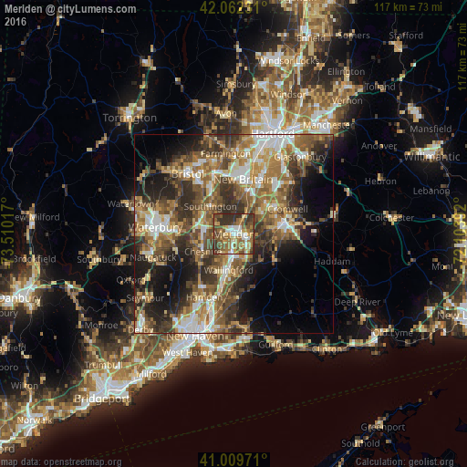
Analysis of Meriden night lights 2016
Square area 10x10 km:
 9.52%
9.52%90-99
9.69%80-89
7.82%70-79
11.05%60-69
16.16%50-59
16.16%40-49
9.69%30-39
15.99%20-29
3.91%10-19
0%0-9
0%Square area 50x50 km:
5.57%90-99
5.97%80-89
4.95%70-79
6.33%60-69
7.59%50-59
9.18%40-49
7.79%30-39
8.28%20-29
9.31%10-19
10.82%0-9
24.2%Clear (daylight) street map image can be seen on geolist.org.
Map coordinates:
42° 3' 44.3" North, 73° 30' 36.6" West
41° 32' 17.3" North, 72° 48' 25.3" West
41° 0' 35" North, 72° 6' 14.1" West
Some cities around Meriden sort by population:
• New Britain
13.9 km =8.6 mi,  9°
9°
• Middletown
13.3 km =8.3 mi,  78°
78°
• Cheshire
8.9 km =5.5 mi,  240°
240°
• Wallingford Center
9.9 km =6.2 mi,  185°
185°
• Wallingford
9.1 km =5.7 mi, 188°
• Kensington
11.3 km =7 mi,  16°
16°
• Portland
14.4 km =8.9 mi,  74°
74°
• Cheshire Village
8.7 km =5.4 mi, 242°
4838524 (p: 59,988)
Sources (retrieved 2019-11-25):
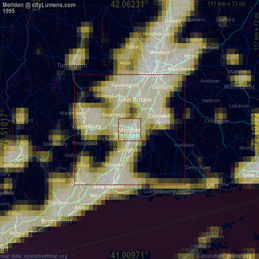
» NASA, Earths city lights 1995
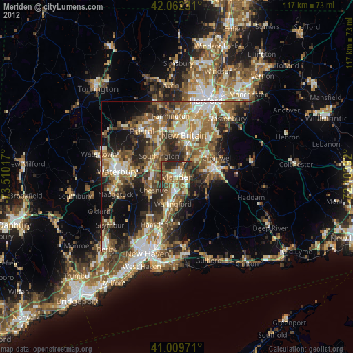
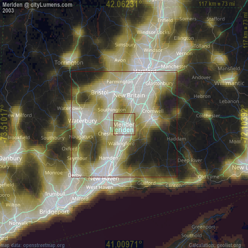
» NASA city lights 2003
» Earth at Night: Flat Maps 2012, 2016