Menominee night lights from space
Night Light of Menominee (Michigan) from space (United States) Src. Average luminocity for 10x10km area is 33.1409% and for 50x50km: 2.2195%.
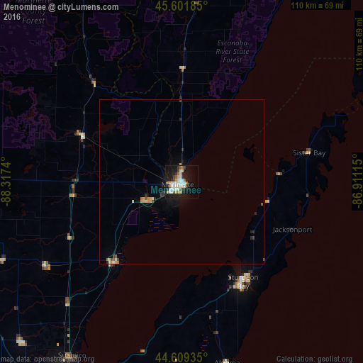
Analysis of Menominee night lights 2016
Square area 10x10 km:
 7.42%
7.42%90-99
7.88%80-89
4.39%70-79
1.82%60-69
2.12%50-59
3.94%40-49
2.58%30-39
3.18%20-29
4.55%10-19
34.39%0-9
27.73%Square area 50x50 km:
0.32%90-99
0.35%80-89
0.29%70-79
0.28%60-69
0.17%50-59
0.26%40-49
0.16%30-39
0.28%20-29
0.4%10-19
1.88%0-9
95.6%Clear (daylight) street map image can be seen on geolist.org.
Map coordinates:
45° 36' 6.7" North, 88° 19' 2.6" West
45° 6' 27.9" North, 87° 36' 51.4" West
44° 36' 33.7" North, 86° 54' 40.1" West
Some cities around Menominee sort by population:
• Green Bay
72.8 km =45.2 mi,  206°
206°
• Howard
73 km =45.4 mi, 210°
• Ashwaubenon
78.3 km =48.7 mi, 207°
• Bellevue
77.6 km =48.2 mi,  198°
198°
• Allouez
76.9 km =47.8 mi, 204°
• Suamico
62.6 km =38.9 mi, 212°
• Marinette
1.6 km =1 mi,  236°
236°
• Sturgeon Bay
35.7 km =22.2 mi,  148°
148°
5001669 (p: 8,382)
Sources (retrieved 2019-11-25):
» Earth at Night: Flat Maps 2012, 2016