McMinnville night lights from space
Night Light of McMinnville (Oregon) from space (United States) Src. Average luminocity for 10x10km area is 26.9606% and for 50x50km: 4.2989%.
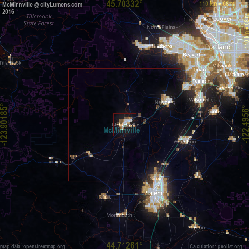
Analysis of McMinnville night lights 2016
Square area 10x10 km:
 5.3%
5.3%90-99
4.39%80-89
0.76%70-79
4.24%60-69
3.33%50-59
4.09%40-49
3.48%30-39
2.73%20-29
1.97%10-19
30.91%0-9
38.79%Square area 50x50 km:
0.49%90-99
0.61%80-89
0.32%70-79
0.57%60-69
0.66%50-59
0.44%40-49
0.57%30-39
0.59%20-29
0.74%10-19
4.11%0-9
90.89%Clear (daylight) street map image can be seen on geolist.org.
Map coordinates:
45° 42' 12" North, 123° 54' 6.7" West
45° 12' 36.4" North, 123° 11' 55.4" West
44° 42' 45.4" North, 122° 29' 44.2" West
Some cities around McMinnville sort by population:
• Salem
32.4 km =20.1 mi,  156°
156°
• Keizer
28 km =17.4 mi,  151°
151°
• Woodburn
27.9 km =17.3 mi,  105°
105°
• Newberg
20.3 km =12.6 mi,  60°
60°
• Hayesville
30.1 km =18.7 mi, 145°
• Sherwood
32.4 km =20.1 mi, 59°
• Dallas
33.6 km =20.9 mi,  196°
196°
• Sheridan
19.7 km =12.2 mi,  231°
231°
5739936 (p: 33,892)
Sources (retrieved 2019-11-25):
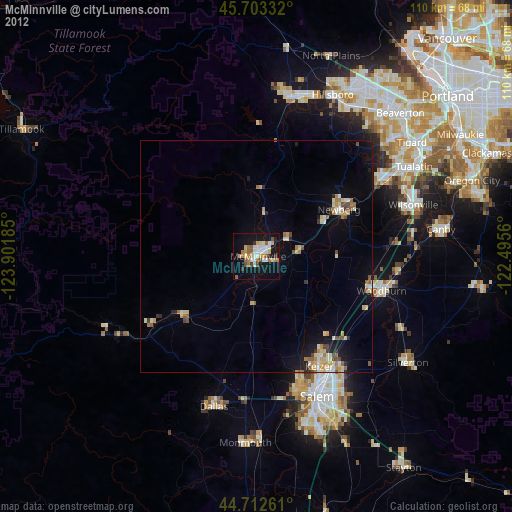
» Earth at Night: Flat Maps 2012, 2016