Salem night lights from space
Night Light of Salem (Oregon) from space (United States) Src. Average luminocity for 10x10km area is 78.7476% and for 50x50km: 9.403%.
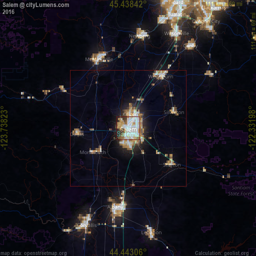

Analysis of Salem night lights 2016
Square area 10x10 km:
 27.62%
90-99
25.56%80-89
8.73%70-79
7.14%60-69
7.62%50-59
6.19%40-49
3.65%30-39
6.03%20-29
4.76%10-19
2.7%0-9
0%Square area 50x50 km:
1.49%90-99
1.83%80-89
1.16%70-79
1.11%60-69
1.58%50-59
1.09%40-49
1.08%30-39
0.98%20-29
1.74%10-19
4.51%0-9
83.44%Clear (daylight) street map image can be seen on geolist.org.
Map coordinates:
45° 26' 18.3" North, 123° 44' 17.6" West
44° 56' 34.4" North, 123° 2' 6.4" West
44° 26' 35" North, 122° 19' 55.1" West
Some cities around Salem sort by population:
• Keizer
5.3 km =3.3 mi,  7°
7°
• Hayesville
6.3 km =3.9 mi,  40°
40°
• Four Corners
4.4 km =2.7 mi,  112°
112°
• Dallas
22.3 km =13.9 mi,  263°
263°
• Monmouth
18.9 km =11.7 mi,  236°
236°
• Silverton
21 km =13 mi,  70°
70°
• Independence
15.7 km =9.8 mi,  229°
229°
• Stayton
24.7 km =15.3 mi,  129°
129°
5750162 (p: 164,549)
Sources (retrieved 2019-11-25):
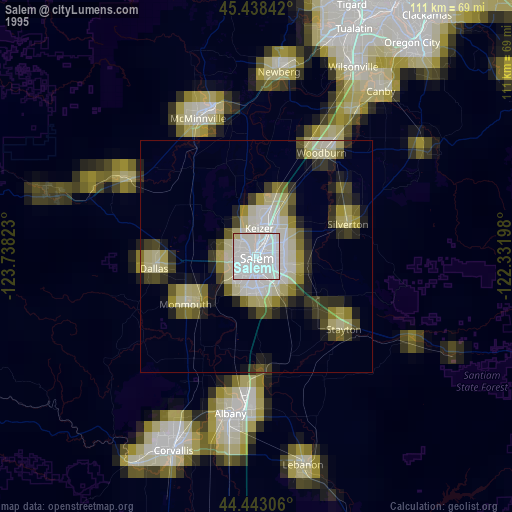
» NASA, Earths city lights 1995
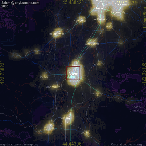
» NASA city lights 2003
» Earth at Night: Flat Maps 2012, 2016