McKinleyville night lights from space
Night Light of McKinleyville (California) from space (United States) Src. Average luminocity for 10x10km area is 12.8333% and for 50x50km: 2.4026%.
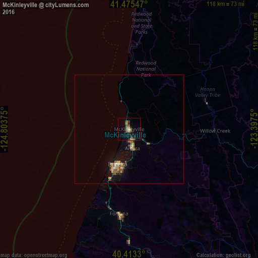
Analysis of McKinleyville night lights 2016
Square area 10x10 km:
 0%
0%90-99
0.34%80-89
1.36%70-79
1.53%60-69
2.89%50-59
3.06%40-49
1.53%30-39
4.59%20-29
4.25%10-19
5.61%0-9
74.83%Square area 50x50 km:
0.09%90-99
0.12%80-89
0.32%70-79
0.38%60-69
0.47%50-59
0.5%40-49
0.34%30-39
0.48%20-29
0.36%10-19
1.77%0-9
95.16%Clear (daylight) street map image can be seen on geolist.org.
Map coordinates:
41° 28' 31.7" North, 124° 48' 13.5" West
40° 56' 47.5" North, 124° 6' 2.2" West
40° 24' 47.9" North, 123° 23' 51" West
Some cities around McKinleyville sort by population:
• Redding
149.4 km =92.8 mi,  105°
105°
• Eureka
16.9 km =10.5 mi,  198°
198°
• Arcata
9 km =5.6 mi,  170°
170°
• Bayside
12 km =7.5 mi,  164°
164°
• Fortuna
39 km =24.2 mi,  187°
187°
• Shasta Lake
148.5 km =92.3 mi,  101°
101°
• Crescent City
90.4 km =56.2 mi,  354°
354°
• Brookings
123.9 km =77 mi, 352°
5567770 (p: 15,177)
Sources (retrieved 2019-11-25):
» Earth at Night: Flat Maps 2012, 2016