Arcata night lights from space
Night Light of Arcata (California) from space (United States) Src. Average luminocity for 10x10km area is 14.1922% and for 50x50km: 2.4656%.
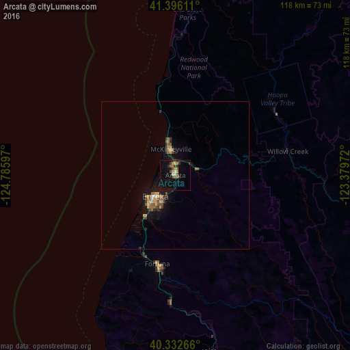
Analysis of Arcata night lights 2016
Square area 10x10 km:
 0.34%
0.34%90-99
0.34%80-89
3.91%70-79
0.85%60-69
1.87%50-59
3.06%40-49
1.87%30-39
3.06%20-29
2.55%10-19
5.44%0-9
76.7%Square area 50x50 km:
0.09%90-99
0.13%80-89
0.33%70-79
0.38%60-69
0.48%50-59
0.51%40-49
0.35%30-39
0.49%20-29
0.4%10-19
1.79%0-9
95.06%Clear (daylight) street map image can be seen on geolist.org.
Map coordinates:
41° 23' 46" North, 124° 47' 9.5" West
40° 51' 59.5" North, 124° 4' 58.2" West
40° 19' 57.6" North, 123° 22' 47" West
Some cities around Arcata sort by population:
• Redding
145.9 km =90.7 mi,  102°
102°
• Eureka
9.9 km =6.2 mi,  223°
223°
• Bayside
3.1 km =1.9 mi,  149°
149°
• McKinleyville
9 km =5.6 mi,  350°
350°
• Fortuna
30.5 km =19 mi,  191°
191°
• Shasta Lake
145.6 km =90.5 mi, 98°
• Crescent City
99.4 km =61.8 mi, 354°
• Brookings
132.9 km =82.6 mi, 352°
5558953 (p: 17,843)
Sources (retrieved 2019-11-25):
» Earth at Night: Flat Maps 2012, 2016