Massillon night lights from space
Night Light of Massillon (Ohio) from space (United States) Src. Average luminocity for 10x10km area is 62.7789% and for 50x50km: 27.3164%.
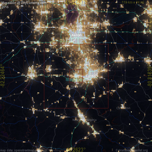
Analysis of Massillon night lights 2016
Square area 10x10 km:
 7.99%
7.99%90-99
10.37%80-89
9.69%70-79
10.37%60-69
18.37%50-59
15.14%40-49
8.16%30-39
7.14%20-29
9.35%10-19
3.4%0-9
0%Square area 50x50 km:
3.12%90-99
4.07%80-89
2.63%70-79
3.45%60-69
5.67%50-59
6.13%40-49
5.55%30-39
4.59%20-29
6.27%10-19
10.54%0-9
47.97%Clear (daylight) street map image can be seen on geolist.org.
Map coordinates:
41° 19' 36.7" North, 82° 13' 28.7" West
40° 47' 48.2" North, 81° 31' 17.4" West
40° 15' 44.3" North, 80° 49' 6.2" West
Some cities around Massillon sort by population:
• Canton
12 km =7.5 mi,  88°
88°
• Green
16.9 km =10.5 mi,  10°
10°
• North Canton
13.3 km =8.3 mi,  48°
48°
• New Franklin
16.2 km =10.1 mi,  354°
354°
• Louisville
22.5 km =14 mi,  78°
78°
• Orrville
21.1 km =13.1 mi,  284°
284°
• Perry Heights
4 km =2.5 mi, 92°
• Canal Fulton
12.2 km =7.6 mi,  328°
328°
5162097 (p: 32,252)
Sources (retrieved 2019-11-25):
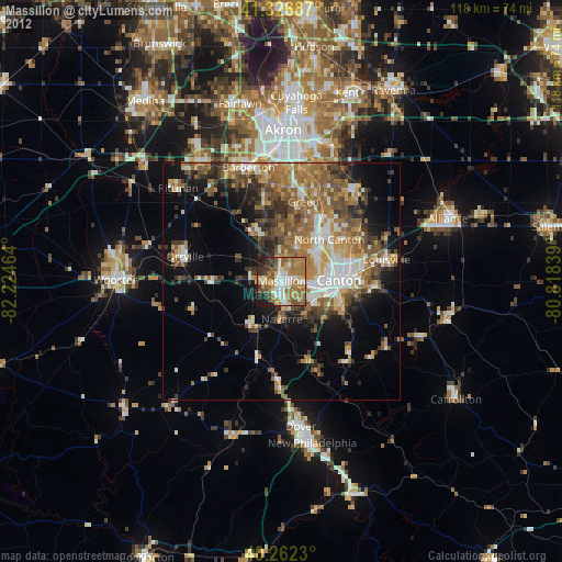
» Earth at Night: Flat Maps 2012, 2016