Canton night lights from space
Night Light of Canton (Ohio) from space (United States) Src. Average luminocity for 10x10km area is 88.4252% and for 50x50km: 27.124%.
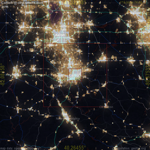
Analysis of Canton night lights 2016
Square area 10x10 km:
 36.22%
90-99
31.97%80-89
7.31%70-79
8.5%60-69
4.08%50-59
5.27%40-49
4.59%30-39
1.87%20-29
0.17%10-19
0%0-9
0%Square area 50x50 km:
3.32%90-99
4.15%80-89
2.69%70-79
3.38%60-69
5.73%50-59
6.07%40-49
5.21%30-39
4.35%20-29
5.94%10-19
9.23%0-9
49.94%Clear (daylight) street map image can be seen on geolist.org.
Map coordinates:
41° 19' 44.7" North, 82° 4' 53.7" West
40° 47' 56.2" North, 81° 22' 42.4" West
40° 15' 52.4" North, 80° 40' 31.2" West
Some cities around Canton sort by population:
• Massillon
12 km =7.5 mi,  268°
268°
• Green
18.6 km =11.6 mi,  331°
331°
• Alliance
26.3 km =16.3 mi,  60°
60°
• North Canton
8.8 km =5.5 mi,  346°
346°
• New Franklin
21 km =13 mi,  319°
319°
• Louisville
10.9 km =6.8 mi,  66°
66°
• Perry Heights
8 km =5 mi, 267°
• Canal Fulton
21 km =13 mi,  298°
298°
5149222 (p: 71,885)
Sources (retrieved 2019-11-25):
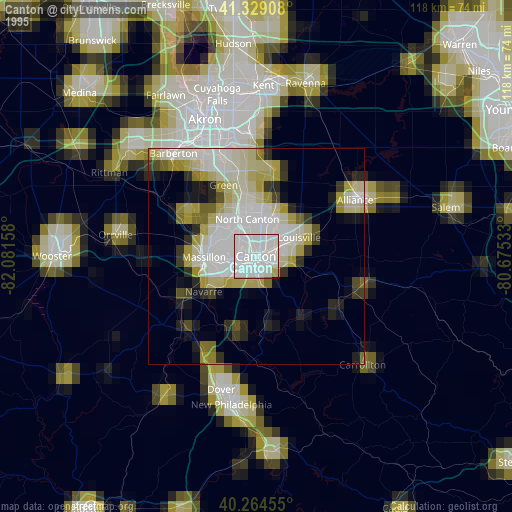
» NASA, Earths city lights 1995
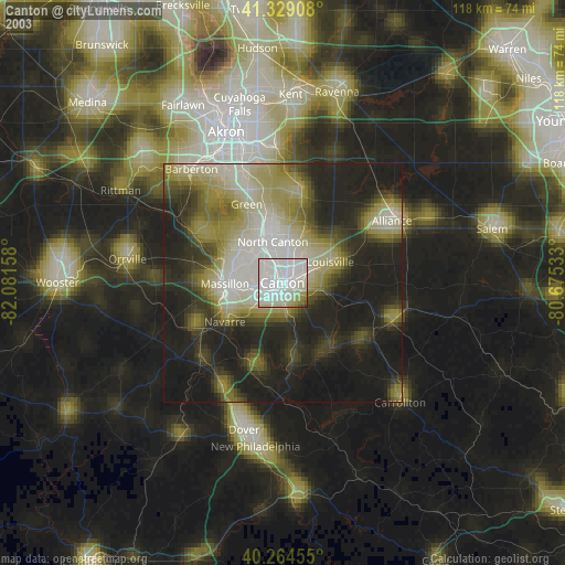
» NASA city lights 2003
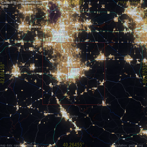
» Earth at Night: Flat Maps 2012, 2016