Echelon night lights from space
Night Light of Echelon (New Jersey) from space (United States) Src. Average luminocity for 10x10km area is 87.6105% and for 50x50km: 61.1979%.
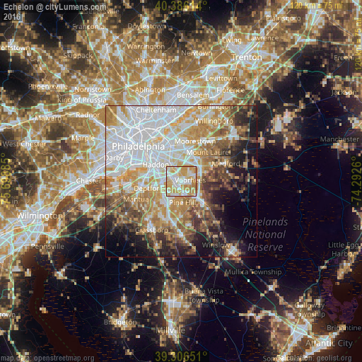
Analysis of Echelon night lights 2016
Square area 10x10 km:
 19.9%
19.9%90-99
27.21%80-89
24.32%70-79
23.81%60-69
4.59%50-59
0.17%40-49
0%30-39
0%20-29
0%10-19
0%0-9
0%Square area 50x50 km:
19.18%90-99
12.27%80-89
7.6%70-79
9.95%60-69
8.74%50-59
5.89%40-49
5.72%30-39
5.73%20-29
5.05%10-19
9.18%0-9
10.68%Clear (daylight) street map image can be seen on geolist.org.
Map coordinates:
40° 23' 10.1" North, 75° 41' 55.9" West
39° 50' 54.4" North, 74° 59' 44.6" West
39° 18' 23.4" North, 74° 17' 33.4" West
Some cities around Echelon sort by population:
• Lindenwold
2.7 km =1.7 mi,  183°
183°
• Haddonfield
6 km =3.7 mi,  323°
323°
• Greentree
6.4 km =4 mi,  32°
32°
• Runnemede
6.2 km =3.9 mi,  274°
274°
• Ashland
1.9 km =1.2 mi,  331°
331°
• Stratford
2.9 km =1.8 mi,  214°
214°
• Barrington
5.4 km =3.4 mi,  289°
289°
• Somerdale
2.4 km =1.5 mi,  257°
257°
4501632 (p: 10,743)
Sources (retrieved 2019-11-25):
» Earth at Night: Flat Maps 2012, 2016