Malone night lights from space
Night Light of Malone (New York) from space (United States) Src. Average luminocity for 10x10km area is 11.2095% and for 50x50km: 0.6616%.
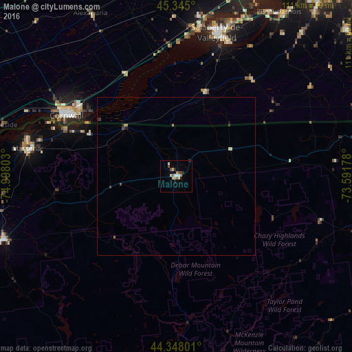
Analysis of Malone night lights 2016
Square area 10x10 km:
 1.59%
1.59%90-99
1.9%80-89
1.59%70-79
1.59%60-69
0.48%50-59
1.75%40-49
1.9%30-39
0.48%20-29
1.75%10-19
0.79%0-9
86.19%Square area 50x50 km:
0.06%90-99
0.1%80-89
0.09%70-79
0.06%60-69
0.12%50-59
0.09%40-49
0.13%30-39
0.07%20-29
0.13%10-19
0.1%0-9
99.06%Clear (daylight) street map image can be seen on geolist.org.
Map coordinates:
45° 20' 42" North, 74° 59' 52.9" West
44° 50' 55.2" North, 74° 17' 41.6" West
44° 20' 52.8" North, 73° 35' 30.4" West
Some cities around Malone sort by population:
• Cornwall, CA
39 km =24.2 mi,  298°
298°
• Salaberry-de-Valleyfield, CA
46.4 km =28.8 mi,  15°
15°
• Les Coteaux, CA
48.6 km =30.2 mi,  5°
5°
• Massena
47.8 km =29.7 mi,  280°
280°
• Potsdam
57.7 km =35.9 mi,  249°
249°
• Coteau-du-Lac, CA
51 km =31.7 mi, 9°
• Saint-Zotique, CA
44.8 km =27.8 mi,  4°
4°
• Saranac Lake
59.2 km =36.8 mi,  167°
167°
5125717 (p: 5,756)
Sources (retrieved 2019-11-25):
» Earth at Night: Flat Maps 2012, 2016