Lyndhurst night lights from space
Night Light of Lyndhurst (Ohio) from space (United States) Src. Average luminocity for 10x10km area is 89.2602% and for 50x50km: 46.0698%.
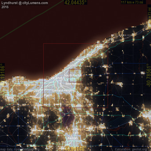
Analysis of Lyndhurst night lights 2016
Square area 10x10 km:
 34.86%
90-99
33.84%80-89
11.22%70-79
5.44%60-69
4.76%50-59
6.63%40-49
3.23%30-39
0%20-29
0%10-19
0%0-9
0%Square area 50x50 km:
15.47%90-99
10.51%80-89
3.77%70-79
4.11%60-69
6.36%50-59
5.33%40-49
4.89%30-39
4.72%20-29
6.37%10-19
8.39%0-9
30.08%Clear (daylight) street map image can be seen on geolist.org.
Map coordinates:
42° 2' 39.7" North, 82° 11' 30.7" West
41° 31' 12.2" North, 81° 29' 19.4" West
40° 59' 29.3" North, 80° 47' 8.2" West
Some cities around Lyndhurst sort by population:
• Cleveland Heights
5.6 km =3.5 mi,  270°
270°
• South Euclid
2.5 km =1.6 mi,  277°
277°
• Mayfield Heights
2.6 km =1.6 mi,  92°
92°
• University Heights
4.7 km =2.9 mi,  238°
238°
• Beachwood
6.4 km =4 mi,  195°
195°
• Richmond Heights
4.1 km =2.5 mi,  333°
333°
• Highland Heights
3.7 km =2.3 mi,  13°
13°
• Pepper Pike
5.1 km =3.2 mi,  155°
155°
5161493 (p: 13,691)
Sources (retrieved 2019-11-25):
» Earth at Night: Flat Maps 2012, 2016