Pepper Pike night lights from space
Night Light of Pepper Pike (Ohio) from space (United States) Src. Average luminocity for 10x10km area is 70.2075% and for 50x50km: 46.5992%.
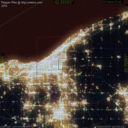
Analysis of Pepper Pike night lights 2016
Square area 10x10 km:
 17.86%
90-99
19.9%80-89
5.44%70-79
5.1%60-69
11.73%50-59
14.97%40-49
10.54%30-39
5.27%20-29
9.01%10-19
0.17%0-9
0%Square area 50x50 km:
14.69%90-99
10.31%80-89
3.8%70-79
4.13%60-69
6.33%50-59
6.12%40-49
5.96%30-39
5.28%20-29
7.09%10-19
8.81%0-9
27.47%Clear (daylight) street map image can be seen on geolist.org.
Map coordinates:
42° 0' 10.9" North, 82° 10' 0.7" West
41° 28' 42.2" North, 81° 27' 49.4" West
40° 56' 58.1" North, 80° 45' 38.2" West
Some cities around Pepper Pike sort by population:
• Shaker Heights
6.1 km =3.8 mi,  265°
265°
• South Euclid
6.7 km =4.2 mi,  317°
317°
• Mayfield Heights
4.6 km =2.9 mi,  6°
6°
• Lyndhurst
5.1 km =3.2 mi,  335°
335°
• Warrensville Heights
7.7 km =4.8 mi,  231°
231°
• University Heights
6.5 km =4 mi,  289°
289°
• Beachwood
4.1 km =2.5 mi,  247°
247°
• Highland Heights
8.3 km =5.2 mi,  351°
351°
5166438 (p: 6,204)
Sources (retrieved 2019-11-25):
» Earth at Night: Flat Maps 2012, 2016