Circleville night lights from space
Night Light of Circleville (Ohio) from space (United States) Src. Average luminocity for 10x10km area is 31.0292% and for 50x50km: 6.9475%.
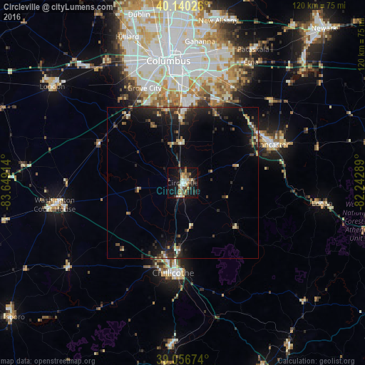
Analysis of Circleville night lights 2016
Square area 10x10 km:
 2.92%
2.92%90-99
5.68%80-89
4.22%70-79
5.36%60-69
3.9%50-59
4.22%40-49
2.92%30-39
6.01%20-29
4.38%10-19
31.66%0-9
28.73%Square area 50x50 km:
0.38%90-99
0.81%80-89
0.69%70-79
0.77%60-69
0.77%50-59
0.95%40-49
1.01%30-39
1.57%20-29
2.95%10-19
7.03%0-9
83.07%Clear (daylight) street map image can be seen on geolist.org.
Map coordinates:
40° 8' 24.9" North, 83° 38' 56.9" West
39° 36' 2.2" North, 82° 56' 45.6" West
39° 3' 24.3" North, 82° 14' 34.4" West
Some cities around Circleville sort by population:
• Columbus
40.3 km =25 mi,  353°
353°
• Lancaster
32.2 km =20 mi,  67°
67°
• Grove City
33.7 km =20.9 mi,  338°
338°
• Chillicothe
29.9 km =18.6 mi,  185°
185°
• Pickerington
35.6 km =22.1 mi,  27°
27°
• Blacklick Estates
34.6 km =21.5 mi,  11°
11°
• Canal Winchester
29.5 km =18.3 mi,  24°
24°
• Groveport
31.3 km =19.4 mi, 9°
4508778 (p: 13,857)
Sources (retrieved 2019-11-25):
» Earth at Night: Flat Maps 2012, 2016