Cypress Lake night lights from space
Night Light of Cypress Lake (Florida) from space (United States) Src. Average luminocity for 10x10km area is 84.9527% and for 50x50km: 40.471%.
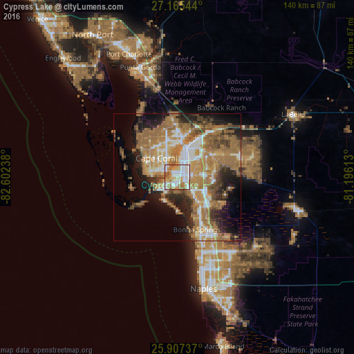
Analysis of Cypress Lake night lights 2016
Square area 10x10 km:
 25%
25%90-99
29.17%80-89
8.14%70-79
13.83%60-69
15.91%50-59
6.44%40-49
1.52%30-39
0%20-29
0%10-19
0%0-9
0%Square area 50x50 km:
5.35%90-99
6.43%80-89
3.76%70-79
6.81%60-69
14.38%50-59
7.85%40-49
4.59%30-39
3.75%20-29
7.07%10-19
9.78%0-9
30.23%Clear (daylight) street map image can be seen on geolist.org.
Map coordinates:
27° 9' 55.6" North, 82° 36' 8.6" West
26° 32' 17.3" North, 81° 53' 57.3" West
25° 54' 26.5" North, 81° 11' 46.1" West
Some cities around Cypress Lake sort by population:
• Cape Coral
5.7 km =3.5 mi,  298°
298°
• Fort Myers
11 km =6.8 mi,  32°
32°
• Estero
14.4 km =8.9 mi,  140°
140°
• San Carlos Park
12.5 km =7.8 mi,  128°
128°
• Iona
6.7 km =4.2 mi,  252°
252°
• Villas
3.3 km =2.1 mi,  65°
65°
• McGregor
3 km =1.9 mi,  329°
329°
• Fort Myers Beach
10.8 km =6.7 mi,  208°
208°
4152639 (p: 11,846)
Sources (retrieved 2019-11-25):
» Earth at Night: Flat Maps 2012, 2016