Fort Myers night lights from space
Night Light of Fort Myers (Florida) from space (United States) Src. Average luminocity for 10x10km area is 89.6383% and for 50x50km: 40.0019%.
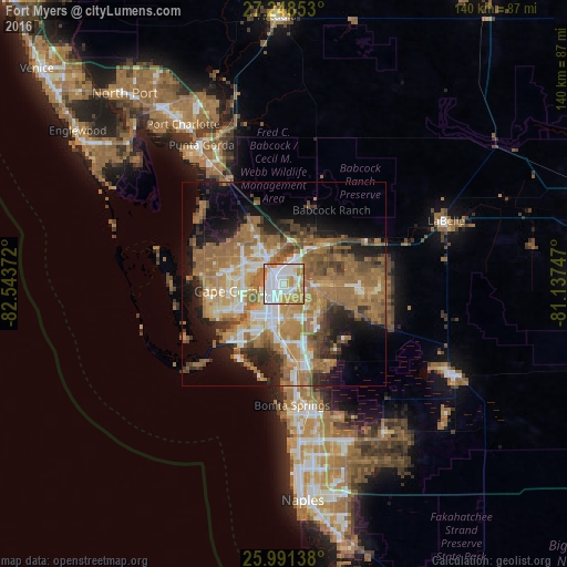

Analysis of Fort Myers night lights 2016
Square area 10x10 km:
 34.09%
90-99
28.6%80-89
8.33%70-79
17.99%60-69
10.61%50-59
0.38%40-49
0%30-39
0%20-29
0%10-19
0%0-9
0%Square area 50x50 km:
4.93%90-99
5.95%80-89
3.3%70-79
6.34%60-69
14.61%50-59
8.8%40-49
5.12%30-39
4.05%20-29
6.32%10-19
10.71%0-9
29.87%Clear (daylight) street map image can be seen on geolist.org.
Map coordinates:
27° 14' 54.7" North, 82° 32' 37.4" West
26° 37' 18" North, 81° 50' 26.1" West
25° 59' 29" North, 81° 8' 14.9" West
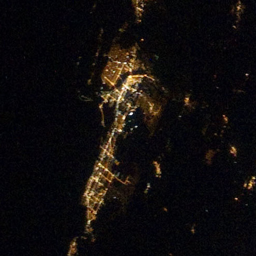
Fantastic image of Fort Myers from space taken by astronauts [src2], but I don't have information about it's orientation, scale or angle. If necessary, it was rotated manually, so North points approximately to upper direction. Click to zoom in:
Some cities around Fort Myers sort by population:
• Cape Coral
12.7 km =7.9 mi,  238°
238°
• North Fort Myers
6.4 km =4 mi,  322°
322°
• San Carlos Park
17.6 km =10.9 mi,  167°
167°
• Iona
16.7 km =10.4 mi,  227°
227°
• Cypress Lake
11 km =6.8 mi,  212°
212°
• Villas
8.4 km =5.2 mi,  199°
199°
• Gateway
10.2 km =6.3 mi,  118°
118°
• McGregor
10 km =6.2 mi, 227°
4155995 (p: 74,013)
Sources (retrieved 2019-11-25):
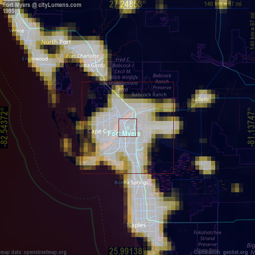
» NASA, Earths city lights 1995
» NASA city lights 2003
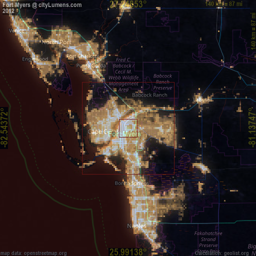
» Earth at Night: Flat Maps 2012, 2016
Src.2: Space Station Gallery NASA