Lebanon night lights from space
Night Light of Lebanon (Ohio) from space (United States) Src. Average luminocity for 10x10km area is 45.7755% and for 50x50km: 37.3005%.
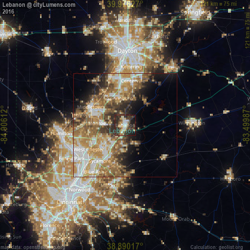
Analysis of Lebanon night lights 2016
Square area 10x10 km:
 5.95%
5.95%90-99
7.65%80-89
4.59%70-79
6.8%60-69
3.74%50-59
4.08%40-49
11.73%30-39
18.37%20-29
22.96%10-19
12.76%0-9
1.36%Square area 50x50 km:
5.86%90-99
7.42%80-89
4.84%70-79
7.06%60-69
6.75%50-59
6.83%40-49
5.03%30-39
5.09%20-29
5.73%10-19
6.69%0-9
38.69%Clear (daylight) street map image can be seen on geolist.org.
Map coordinates:
39° 58' 34.6" North, 84° 54' 22" West
39° 26' 7.2" North, 84° 12' 10.8" West
38° 53' 24.6" North, 83° 29' 59.5" West
Some cities around Lebanon sort by population:
• Middletown
19 km =11.8 mi,  297°
297°
• Mason
12.4 km =7.7 mi,  227°
227°
• Springboro
13.3 km =8.3 mi,  348°
348°
• Monroe
13.7 km =8.5 mi,  272°
272°
• Loveland
19.2 km =11.9 mi,  195°
195°
• Franklin
16.3 km =10.1 mi,  327°
327°
• Landen
15.3 km =9.5 mi,  206°
206°
• Carlisle
19.2 km =11.9 mi, 328°
4516412 (p: 20,623)
Sources (retrieved 2019-11-25):
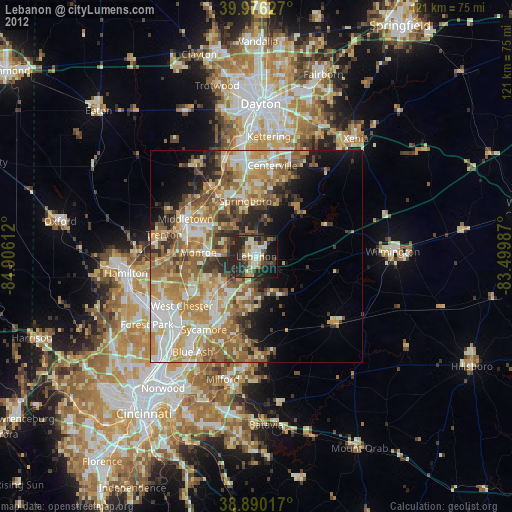
» Earth at Night: Flat Maps 2012, 2016