Layhill night lights from space
Night Light of Layhill (Maryland) from space (United States) Src. Average luminocity for 10x10km area is 74.7192% and for 50x50km: 68.1105%.
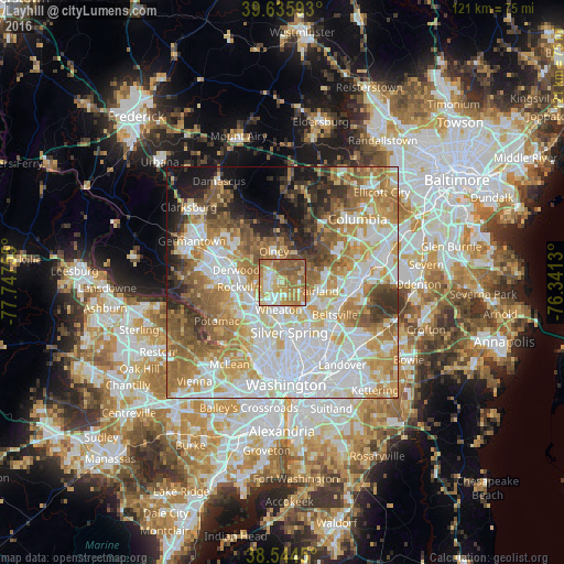
Analysis of Layhill night lights 2016
Square area 10x10 km:
 10.06%
90-99
12.99%80-89
12.82%70-79
20.13%60-69
24.19%50-59
18.83%40-49
0.97%30-39
0%20-29
0%10-19
0%0-9
0%Square area 50x50 km:
19.42%90-99
15.03%80-89
8.97%70-79
11.19%60-69
11.09%50-59
8.96%40-49
5.03%30-39
4.87%20-29
4.77%10-19
6.63%0-9
4.04%Clear (daylight) street map image can be seen on geolist.org.
Map coordinates:
39° 38' 9.3" North, 77° 44' 51.2" West
39° 5' 32.4" North, 77° 2' 39.9" West
38° 32' 40.2" North, 76° 20' 28.7" West
Some cities around Layhill sort by population:
• Aspen Hill
2.8 km =1.7 mi,  240°
240°
• Wheaton
5.9 km =3.7 mi,  189°
189°
• Cloverly
4.4 km =2.7 mi,  66°
66°
• Colesville
4.1 km =2.5 mi,  116°
116°
• Glenmont
3.9 km =2.4 mi, 186°
• Kemp Mill
6.3 km =3.9 mi,  159°
159°
• Leisure World
2.4 km =1.5 mi,  297°
297°
• Rossmoor
2.6 km =1.6 mi, 298°
4360443 (p: 5,169)
Sources (retrieved 2019-11-25):
» Earth at Night: Flat Maps 2012, 2016