Sunrise night lights from space
Night Light of Sunrise (Florida) from space (United States) Src. Average luminocity for 10x10km area is 77.2183% and for 50x50km: 50.9464%.
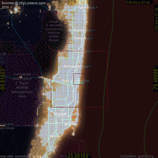
Analysis of Sunrise night lights 2016
Square area 10x10 km:
 48.21%
90-99
11.31%80-89
1.19%70-79
0.4%60-69
5.16%50-59
7.54%40-49
10.91%30-39
7.74%20-29
6.55%10-19
0.99%0-9
0%Square area 50x50 km:
28.99%90-99
13.03%80-89
2.72%70-79
1.88%60-69
1.75%50-59
2.13%40-49
2.41%30-39
2.15%20-29
2.51%10-19
4.18%0-9
38.26%Clear (daylight) street map image can be seen on geolist.org.
Map coordinates:
26° 45' 48.6" North, 80° 48' 58.4" West
26° 8' 2.3" North, 80° 6' 47.2" West
25° 30' 3.7" North, 79° 24' 35.9" West
Some cities around Sunrise sort by population:
• Fort Lauderdale
3.3 km =2.1 mi,  246°
246°
• Lauderhill
10 km =6.2 mi,  274°
274°
• Oakland Park
4.7 km =2.9 mi,  336°
336°
• Dania Beach
9.6 km =6 mi,  198°
198°
• Wilton Manors
3.9 km =2.4 mi,  318°
318°
• North Andrews Gardens
7.1 km =4.4 mi,  334°
334°
• Melrose Park
8.3 km =5.2 mi, 254°
• Lauderdale-by-the-Sea
6.7 km =4.2 mi,  14°
14°
4174402 (p: 84,439)
Sources (retrieved 2019-11-25):
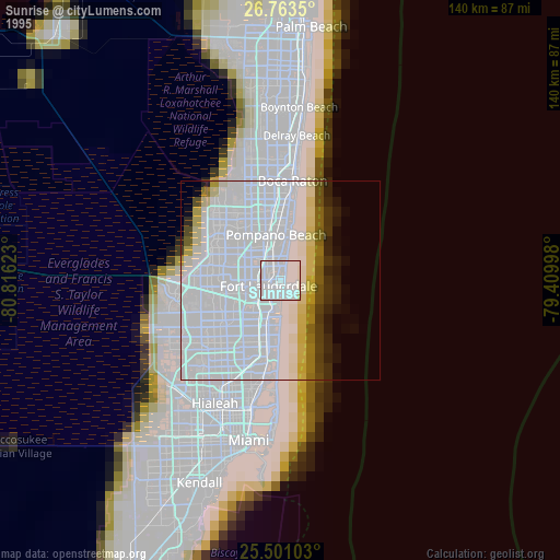
» NASA, Earths city lights 1995
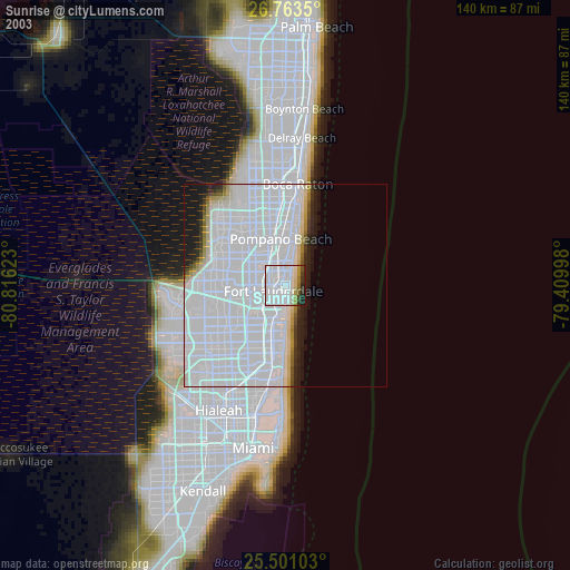
» NASA city lights 2003
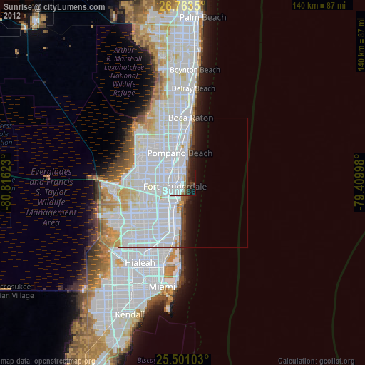
» Earth at Night: Flat Maps 2012, 2016