Las Cruces night lights from space
Night Light of Las Cruces (New Mexico) from space (United States) Src. Average luminocity for 10x10km area is 78.3864% and for 50x50km: 8.978%.
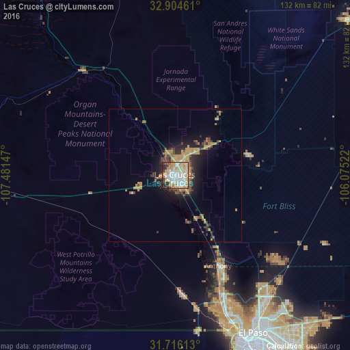

Analysis of Las Cruces night lights 2016
Square area 10x10 km:
 23.08%
90-99
21.25%80-89
12.64%70-79
17.03%60-69
7.69%50-59
2.2%40-49
1.83%30-39
7.14%20-29
6.23%10-19
0.92%0-9
0%Square area 50x50 km:
1.01%90-99
0.97%80-89
0.8%70-79
2.73%60-69
1.42%50-59
0.8%40-49
1.31%30-39
1.22%20-29
2.21%10-19
4.61%0-9
82.93%Clear (daylight) street map image can be seen on geolist.org.
Map coordinates:
32° 54' 16.6" North, 107° 28' 53.3" West
32° 18' 44.4" North, 106° 46' 42" West
31° 42' 58.1" North, 106° 4' 30.8" West
Some cities around Las Cruces sort by population:
• Juárez, MX
72.3 km =44.9 mi,  155°
155°
• El Paso
67.4 km =41.9 mi, 155°
• Sunland Park
60.3 km =37.5 mi, 161°
• Chaparral
48.9 km =30.4 mi,  130°
130°
• Anthony
37.9 km =23.5 mi,  154°
154°
• Fort Bliss
65.3 km =40.6 mi, 148°
• Canutillo
47.6 km =29.6 mi, 159°
• Anthony
38.4 km =23.9 mi, 154°
5475352 (p: 101,643)
Sources (retrieved 2019-11-25):
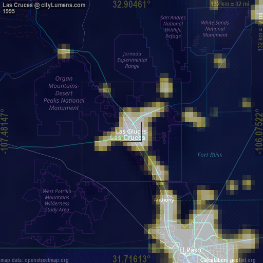
» NASA, Earths city lights 1995
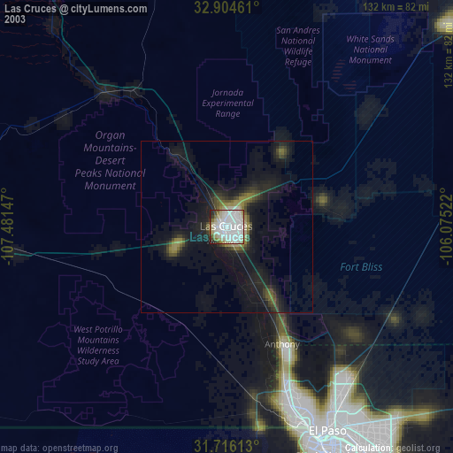
» NASA city lights 2003
» Earth at Night: Flat Maps 2012, 2016