Lambertville night lights from space
Night Light of Lambertville (Michigan) from space (United States) Src. Average luminocity for 10x10km area is 40.6834% and for 50x50km: 27.5889%.
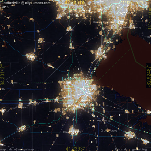
Analysis of Lambertville night lights 2016
Square area 10x10 km:
 2.27%
2.27%90-99
5.68%80-89
4.06%70-79
3.9%60-69
8.12%50-59
15.42%40-49
11.04%30-39
8.28%20-29
7.47%10-19
19.81%0-9
13.96%Square area 50x50 km:
6.28%90-99
6.09%80-89
3.36%70-79
3.62%60-69
4.02%50-59
3.13%40-49
2.89%30-39
3.2%20-29
4.93%10-19
7.94%0-9
54.55%Clear (daylight) street map image can be seen on geolist.org.
Map coordinates:
42° 17' 17.4" North, 84° 19' 52" West
41° 45' 57.2" North, 83° 37' 40.8" West
41° 14' 21.5" North, 82° 55' 29.5" West
Some cities around Lambertville sort by population:
• Toledo
12.8 km =8 mi,  151°
151°
• Oregon
17.9 km =11.1 mi,  139°
139°
• Sylvania
8.8 km =5.5 mi,  233°
233°
• Maumee
22.7 km =14.1 mi,  185°
185°
• Temperance
5.1 km =3.2 mi,  73°
73°
• Rossford
18.1 km =11.2 mi,  163°
163°
• South Monroe
22.6 km =14 mi,  50°
50°
• Northwood
22 km =13.7 mi, 143°
4998769 (p: 9,953)
Sources (retrieved 2019-11-25):
» Earth at Night: Flat Maps 2012, 2016